ContFmPreviousPhoto:
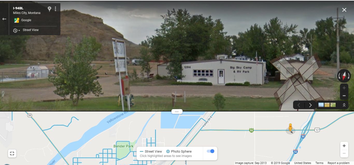
~8:24 pm Mon 12 Aug: Arriving At Big Sky Campground (Side By Side With The Traffic Noise of BOTH US 12 & I-94), Miles City, MT.
.
Its Been A GOOD Day, Of Exploring Remote Areas Of Montana! And Henry Was Tired Enough To Sleep Well, Despite The Constant Thump-Thump, Racket Of The Trucks, All Night Long.
Henry Gurrs tent was on a green grassy area, beneath trees seen at left edge of /\above/\ GSV. After we get a good shower, and despite the noise of trucks rumble & thump, ~100 feet away, a good nights sleep was to be had.
As is shown on the GSV Strip Map, Henry exit Big Sky, he will turn right East, onto US 12, cross I-94, and continue up the Mountain Pass: Going East, this will continue on => The Travel Route of the book, Zen And The Art Of Motorcycle Maintenance.
Several Facts Relevant To The Next 11 Photos, Which You Should Please Keep In Mind =>:
...A) In the Photo Above => The big rock formation seen in upper left (look close for horizontal layers), is part of the foothill beginnings of the Minor Ridge discussed further in B) below. This Ridges rock formation, (also seen in US 12 rode cuts ahead), are actually composed of multi-colored layers of volcanic dust, giving evidence of very long history of eruptions, likely through eons of time, from Yellowstone National Park, massive volcanic eruptions some 335 miles away to Southwest.
B) Several Miles East of Miles City, MT, there is a Major Ridge This Ridge, which looks like a minor mountain ridge, that in this area of Montana, forces the Eastward trending Yellowstone River to turn ~45 degrees, and go Northeast, to eventually join the Missouri River close to the Montana / North Dakota border. Important Ridge in its River Forcing, but seems to have no official name.
C) This Above-Mentioned Ridge, Because of Its (725 Ft,) Elevation Increase Will Feature In Next 11 Photos Of This Album. And Be A Focus Of The Discussion, especially in Relation to the ZMM Narrators description of US 12, for the next 25 miles East. In these Forthcoming 11 Photos you will see for the elevation from the Yellowstone River at Miles City, MT (2330 Ft), climbs with US 12 to Ridge Top (3127 Ft.) at Main Ridge Road, and this elevation increase is reflected in the amount of Rainfall And Thus Forested Meadow. Correspondingly you will see this is An Important DRAMATIC FOUNDATIONAL ELEMENT In Last Half Of ZMM Chapter 7 =>
.,
Especially at This Ridge-Top =>Where The Narrators RAIN + SUDDENLY COOL is for him, Chris & the Sutherlands => SUCH A DELIGHT, and CONTRAST: Especially AFTER Having Suffered Through Eastern Montana WHERE =>
the thermometers are reading 108 degrees in the shade. +
.D) To Help You Understand The Many, Many Important Ramifications of A), B), &,C) as well as how the Narrative of ZMM Chapter 7, is controlled by Terrane Of This Minor Ridge, you may wish to have up in a separate Browser Frame, Please Right Click & Select New Tab, & after page comes up, study Henry Gurrs PART TWO & PART THREE, which you scroll down to.
Cont Next.Photo:
Photo File = GoogStVu BigSkyGnd EasSideMilesCityMT MapShoYsRif+I94TruckNoise}HstTent.jpg
Posted 4 June 2020, Revised 4 June & 18 May & 19 Oct & 3 Nov & 10 Nov 2020.