Added July, 2004
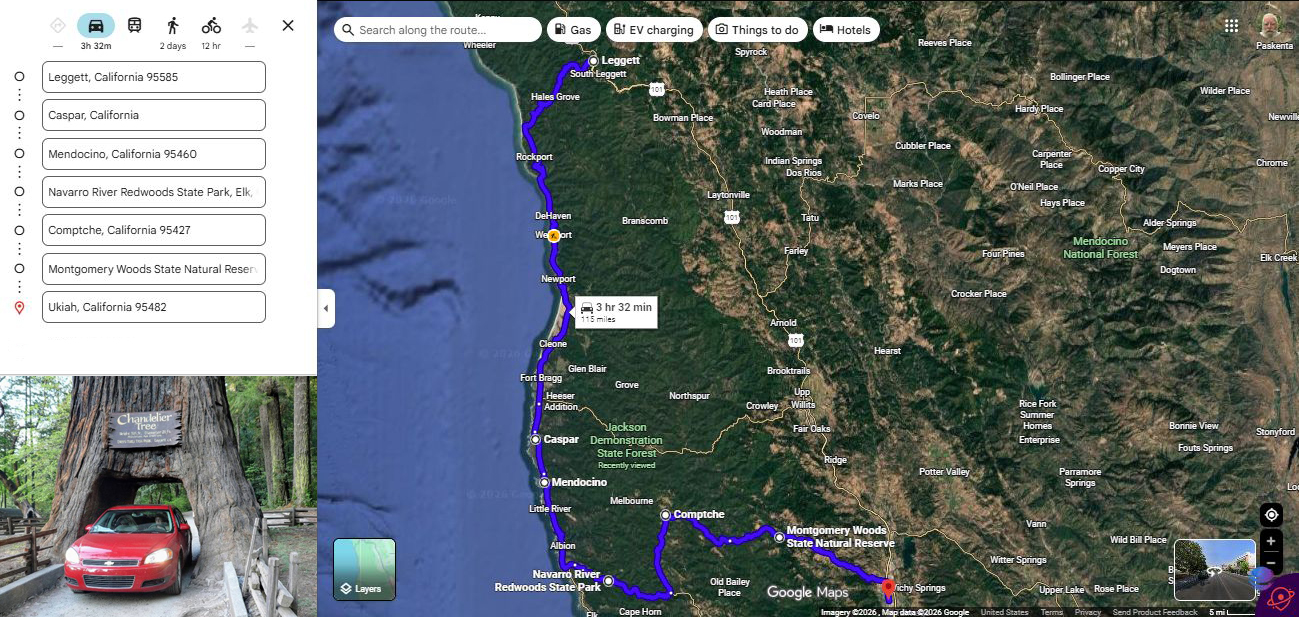
SATELLITE VIEW OF ZMM ROUTE, SOUTH FROM LEGGET, CA =>
At Top Left Of Center, You See Legget, CA. From Which You Can Follow Rt-1 California Coast Highway THRU Fort Bragg, CA. THRU TO Casper, CA (Below Center, Along The Pacific Ocean Coast). THRU Mendocino, CA. THRU Navarro River Redwoods State Park, Elk, CA. THRU Comptche, CA. THRU Montgomery Woods State Natural Reserve, CA. TO Ukiah, CA.
In /\Above/\ Photo, At Lower Left Is => The Drive-Through Redwood Tree, At Legget, CA, Photo Compliments Of Google Maps. .
NOTE1: The above-mentioned "Drive-Through Redwood Tree, happens to be where The ZMM Narrator Says =>
Farther on at Leggett we see a tourist duck pond and we buy Cracker Jacks and throw them to the ducks and he does this in the most unhappy way I have ever seen.
But Author Robert Pirsig greatly dislikes tourist attractions, as well as hates human alterations on nature. For these reasons, the close-by presence of the "Drive-Through Redwood Tree, is not even hinted at!
To See FOUR Of Henry Gurrs 2002 ZMM Trip Photos, Showing The "Drive-Through Redwood Tree And The Narrators Tourist Duck Pond , Click Here. And, AFTER The FIRST Photo. Comes Up, Read & Study It. Then When Ready, Successively Click On [>>} Upper Right, To Go To The Remaining THREE Photos.
********************
EXPLANATION:
Wednesday, July 24, 2024David Mator & Henry Gurr start their day at the Benbow SRA Campground, a few miles South of Garberville, CA. and had to get from their Campground to Caspar Bay, some 70 miles, post hast, to meet Steve & Nancy Sappington by 10:30 am. Consequently, for this stretch of the ZMM Route, David & Henry could not take time to stop to take photographs of any worthy sights: Especially so, since Henrys 2002 Photos were/are sufficient for this travel portion, and can be viewed in forthcoming photos.
Scenes of David & Henrys visit with Steve & Nancy at Caspar, CA, and later at lunch in Mendocino, CA, you will also see in forthcoming photos.
. After lunch Mendocino, CA, David & Henry returned to Rt-1 California Coast Highway South, and completely failed to notice that we missed the ZMM Route Eastward turn-off onto the Comptche-Ukiah Road, which was just after the bridge for the so-named Big River, which is about 3 miles North of Little River, shown on /\Above/\ Satellite View. .
And, as shown in /\Above/\ Satellite View, you can see our detour took us~ 20 miles South of Little River, along the California Coast, until we found a good road east, which then turned onto a secondary road North to Comptche, CA..
You May Go To The /\Above/\ Satellite View, And Conduct Your OWN ClickDrag Exploration (Plus Zoom In For More Detail). Click Here..
File = ScrnCap GoogSaLeggetCasparMendocinoNavaroCompthceUhiah CrescentCyLightHouse
