July 2024 Added:
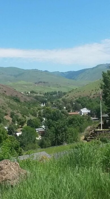
Looking Approximately North From A High Hillside, A View Of The Small Town Of White Bird, Idaho.
On The Right, Above The Green Trees, At Mid Height And Looking Closely Beyond The Slope Of Hill Edge, See The Light Grey Of A Road, Which Most Likely A Lower Portion Of Older US-95, What Is Called White Bird Grade.
EXPLANATION:
Somehow In Taking The Previous 4 ZMM Route Photos, Henry Gurr Did NOT Take Any Photos Showing Views In The ZMM Town Of White Bird, ID.
. Nor Does Google Street View Have Any Views Of Anywhere Along, Older US-95 (What Is Called White Bird Grade) OR In This Town.
CONSEQUENTLY =>
The First 3 Of The Following Seven Photos, Will Provide Added Views Along Older US-95. And The Last 4 Of The Following Seven Photos, Will Provide A Bit Of This Towns Flavor. Please Know That =>
Please Know That =>
These 7 Pictures Were Volunteer Uploaded To AND Found On, Google Maps, For Town Of White Bird, ID. Click Here. .
This Google Map collection of Photos is among the largest I have seen! And following the ZMM Track Of Quality, these photos have been placed there, because: => They were taken by persons who were excited & rewarded by being in Town Of White Bird, and most especially being in boats, catching fish!! These boat experiences were on the waters of White Bird Creek, or ~2 miles away (by way of White Bird Creek), to the much larger Salmon River.
*********************
File = ViewWhiteBirdID FmHill=475974416_1033212752175129_6702959159880746688_n.jpg