July 2024 Added:
At The Start Of Chapter 25: The ZMM Narrator says =>
This morning a solution to the problem of stuckness was discussed, the classic badness caused by traditional reason. Now its time to move to its romantic parallel, the ugliness of the technology traditional reason has produced.
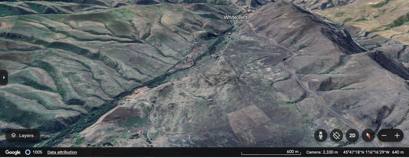
The road has twisted and rolled over desert hills into a little, narrow thread of green surrounding the town of White Bird
**********
The /\Above/\ Google Earth View Is Shown, Becausee Henry Gurr Did NOT Take A Photos For The ZMM Narrators =>
Into A Little, Narrow Thread Of Green Surrounding The Town Of White Bird
**********
The /\Above/\ Google Earth View, Where (Contrary To Maps & Satellite Views, NORTH Is At BOTTOM), Will Serve To Well Illustrate The Narrator, Because Starting At Lower Left, You See The Line Of Green Trees Essentially Along White Bird Creek, Straight To The Small Town Of White Bird, ID, Which Is Hard To See Under The e In The Words White Bird. This Thread Of Trees Gets Extra Moisture From The Creek.
Similarly, Also Going To White Bird Town, Also Seen At Right ->The Line Of The Newer US-95 Highway, Positioned Along The Mountainside. And If You Carefully Follow This Newer US-95 Highway, Up To Just Above The d In The Words White Bird. NOW, Looking VERY Closely, You See The Newer US-95, Crosses A Hard To See Canyon. On A Very High & Long Modern Bridge. In An Upcoming Photo Titled Achieved At Some Expense, You Will See This Wonderful Bridge.
And Similarly, Looking Carefully, Starting Just Left Of Bottom Center You Can See The Roadway Of The Older US-95, Called White Bird Grade. And Find Its Trace Most Places, Upward, All The Way To Upper Center Screen. Some Places Are A Less Obvious & Fant Line, Of The Roadway Of The Older US-95.
The NEXT FOUR Photos, Show Views Along The Last Mile Of This Roadway Line Toward White Bird Town, Which You See Under The t In The Words White Bird.
File = ScrnCapt GoogleEarth ZmmNarratorNarrowThreadGreen+Nu&OldUS-95ToWhtBdTown.jpg
Click Here To Go To The Online Version Of GoogleEarth, and Starting With A View Same As In Photo Above, You Can Now Dynamically Explore On Your Own, The Roadways Of Either The Older Or The Newer US-95 Highways. And Then Go Beyond!
****************************
