July 2024 Added:
THIS GOOGLE EARTH VIEW WILLPREPAREYOU FOR THE NEXT FIFTEEN PHOTOS THAT FOLLOW.
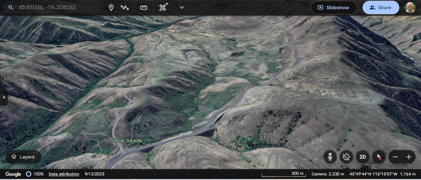
In The /\Above/\ GoogleEarth. At Lower Edge You See => Poe Saddle Where, Looking Closely =>
A) You Can See Right, The Newer US-95 Going Along The Mountain Sides, And Turning Gradually To The Left As It goes Into The Distance Toward Photo Top. AND since this Newer US-95 was opened in 1975, Robert Pirsig & Chris had to negotiate the below B) =>
B) You Can See The Older US-95 Go Up Thru The Word Poe, And Zig-Zag for 4 inches up the screen. And then looking somewhat to the right, this road continues to, and along, the faint road lines you see Upper Central Photo => Where this older US-95 does the ZMM Narrators => What Must Be A Hundred Hairpin Turns Mentioned (Previous Photo).
C) At Top Center You See The END Of a little, narrow thread of green . These are a Tree Lined Valley/Canyon, into which, the Older US-95 Eventually Drops, And Then Leads To The Small Town Of White Bird, ID.
NOTE: This is seen more clearly, close up, in a 2nd Google Earth View, 13 Photos below.
File = ScrnCapt GoogleEarth ShowOldUS-95 PlaceSee100Hairpins~AnsIsNo01
Click Here To Go To The Online Version Of GoogleEarth, and Starting With A View Same As In Photo /\Above/\.
AFTER this comes up, you can Dynamically Explore on your own, the Roadways of either The Older or The Newer US-95 Highways.
****************************