A REPEAT OF PREVIOUS SATELLITE VIEW FOR SUMMARY OVERVIEW =>
The /\ABOVE/\ SATELLITE VIEW SHOWS, THE LOCATIONS OF MANY SUBJECTS MENTIONED IN PREVIOUS PHOTOS, SUCH AS =>
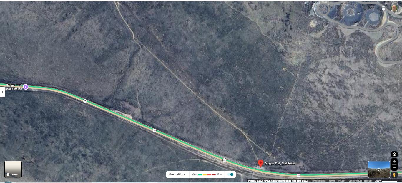
A) Upper Right, The National Historic Oregon Trail Interpretive Center & Surrounding Roads, Which Is At The Top Of Historic Flagstaff Hill.
B) At Red PinPoint, Is Location Of => The Previous Photos, Oregon Trail Display Information Signs, Along Rt-86, Just West Of The Entrance Road To The National Historic Oregon Trail Interpretive Center, 3 mi East of Baker City, Oregon.
C) About Half Inch Northeast Of Red PinPoint, Is Location Of => Previous Photo Wooden Rails, With A Sign, Which Tells Where To See The Ruts.
D) Above C), Minus 40 Feet, Is Approximately The Camera Location Of Previous Panoraga Photo.
E) Going NorthWest From The Red PinPoint, Is A Somewhat White Straight Line. This Is A Walking Trail, That Leads To Where People Can Continue On The Ruts Of The Historic Oregon Trail, Which Is A Much Longer, Somewhat White Straight Line.
F) At Top Left Of Center, In Addition To The Somewhat White Straight Line, You See A Partly Parallel Deep Groove, Which Is Evidently An Even Deeper Rut
********************
Click Here, To Go To The /\Above/\ Satellite View, And Conduct Your OWN ClickDrag Exploration (Plus Zoom In For More Detail),
File = SaVu NationalHistoricOregonTrailInterpretiveCenter&OregonTrailRuts
