Sunday, July 21, 2024:
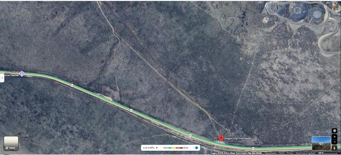
A Satellite View Of Historic Oregon Trail Ruts!, Which Are The Still Visible Marks & Gouges, Left By The Passage Of The Huge Number Of Emigrant Wagons That Came By Flagstaff Hill, Seen Upper Right Showing The National Historic Oregon Trail Interpretive Center And Access Roads
At Bottom Of Screen, You See These Ruts, Starting Above Words Oregon Trail Head, And Leading Northwest, Which Is Down Into Baker, Oregons Valley.
Upper Right, You Also See A Modern Day Trail, That Visitors Can Walk Down, From Interpretive Center, To See Ruts At The The Base Of Flagstaff Hill.
Since Henry Gurr Failed (July 2024), To Get Any Good Ruts Photos, Shown /\Above/\ Is From Google Maps, More Of Which Are To Be Found By A Mouse- Click, At Blue Link Below.
Click Here, And AFTER This Google Map Photo Collection Comes Up, You Should See Very Nice Photo Of Ruts Leading West Down Into Baker, Oregons Valley, And Beyond Are The Elkhorn Mountains. You Should Also See Upper Left Words => Oregon Trail. Trail Head. Gerald H.
File = SaVu HistoricOregonTrailRuts AtBaseOfFlagstaffHillSeeSlopeRight.FmGoogMap