Monday, July 22, 2024:
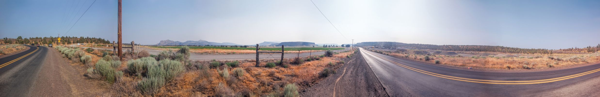
A Panorama Showing The Two Way Junctions Of The Prineville Railroad, To The Main North-South Santa Fe Railroad RR Track, Which Is Seen At The Left Panorama End, Which Is Looking South.
Scrolling To The Right, You See A Second RR Track, Which Is A Second Set Of The Main North-South Santa Fe Railroad RR Tracks.
Beyond The Buildings In The Distance, And This Side Of The Red Hill, Is The ZMM Narrators Very Busy North-South Highway 97, where well turn south,
Scrolling More To The Right, You See Both RR Tracks Disappear North, Into The Distance.
And Below The Distant Gray Hill, Looking Closely, You Can Barely Discern, Curved RR Tracks: These Are The Prineville Railroad Tracks, Which Junction To The North-Going Santa Fe Railroad RR Tracks. And, To The Right, These Disappear Into The Distance Beyond The Clump Of Large Trees.
Scrolling More To The Right, You See RR Tracks Below The RR Track Warning Lights & Gate Arm:
These Are Also The Prineville Railroad Tracks, Which Will Junction To The South-Going Santa Fe Railroad RR Tracks.
Scrolling More To The Right, You See These Prineville Railroad Tracks Join To The South-Going Santa Fe Railroad RR Tracks.
NOTE: AFTER The Below Blue Link Comes Up, You Can Study => How The Prineville Railroad Tracks, Join Int The Santa Fe Railroad RR Tracks. <
For A Close Up Satellite View, In Which You Can See At The Red PinPoint,=> How The Junctioning RR Tracks, Form A Rough Triangle => A) One Way The Tracks Curve To The North, And B) The Other Way Curve To The South, As They Come To The Main Tracks Of The Santa Fe Railroad. Click Here.
********************
SUMMARY:
As Mentioned Previous Photos, What The ZMM Narrator Called Prineville Junction. Is In Reality Is Not A Town, But MERELY & ONLY, The Location Of A Joining Of The Railroad Tracks From Prineville, Oregon, To The Main Tracks Of The Santa Fe Railroad.
The ZMM Narrator Says =>
We arrive in Prineville Junction with only a few hours of daylight left. Were at the intersection with Highway 97, where well turn south,
. .
**AHA** => How I, Henry Gurr, Finally 5 Years Later, Found Out WHERE Prineville Junction, Oregon, Just Happened To Be Located!!
In above passage the ZMM Narrators Prineville Junction., readers would assume is a towns name.
. But In my Henry Gurrs 2002 ZMM Route Research, the 1988 Rand-McNally Map I carried with me, did NOT show any apparent Town of Prineville Junction, Oregon.
...And thus unfortunately in 2002, I missed going to (or photographing) this location, because the town and the Narrators road to go there, were NOT marked on the map I carried with me.:-((.
,,,But belatedly & 5 years later => With the help of TopoZone Maps, I accidently discover, that there was indeed A Prineville Junction, Oregon, 17 miles West of Prineville, Oregon, and is/was located very close to the Narrators => Highway 97, Where Well Turn South,.
But Even Much Later, By Happenstance, I Belatedly Discovered Prineville Junction, Oregon Was Indeed ALSO Marked On A Road Map, Along With Also The Town Of ONeil, Oregon.
.This was on my 1964 Rand-McNally Map, just 4 years older, and old enough to still show Prineville Junction, Oregon.!
Thus, eventually I learned that => What I had supposed was a town was MERELY, LITERALLY, & ONLY => An Actual True Railroad Junction, where The Prineville Railroad, joins the Burlington Northern Santa Fe Main Railroad Tracks.
AND this ORIGINALLY was no more than A Dot On A Map, which is/was just 0.36 mile East of the ZMM Narrators US-97, and four miles North of Redmond, Oregon.
.AND, of course, old maps are likely how Author Robert Pirsig first knew of Prineville Junction and wrote it into his ZMM Narrative.
********************
Thus Confusion & Doubt Are Banished: All This Above Agrees With The Narrators Above Passage, AND Tells Us =>
A) Practically The Only Effective & ZMM Quality Road Robert Pirsig Could Have Use In 1968, To Travel From Prineville, OR > TO > Prineville Junction, Oregon, Was The ONeil Highway , Rt-370, AND =>
B) This, In Turn, Tells Us The ZMM Route Follows The ONeil Highway, Rt-370, Along The Back Country Scenic Byway. In The Crooked River Valley, And Somewhat Parallels The Route Of The Prineville Railroad..
.To go to Prineville Junction, OR from Prineville, OR MapQuest.com shows => You follow US-26 to the West side of Prineville, then turn left onto Rt-126. Within 500 feet, cross the Crooked River and then turn right onto the ONeil Highway, Rt-370, which soon turns directly West, following the VERY Scenic Crooked River Valley!!
.Here we must mention that this => VERY Scenic Crooked River Valley, is in terms of Robert Pirsig and The ZMM Narrator, a High Quality Road, to be sought out by the ZMM Enthusiast!
.So NOW You Understand Where This Name Prineville Junction Came From!!
********************
File = DSC 0547Sb534 PhotoSetOfHGUpLdJan142025OnielHyCurvLt Resize2475x400