Sunday, July 21, 2024:
Twelve Minutes After The Previous Photo
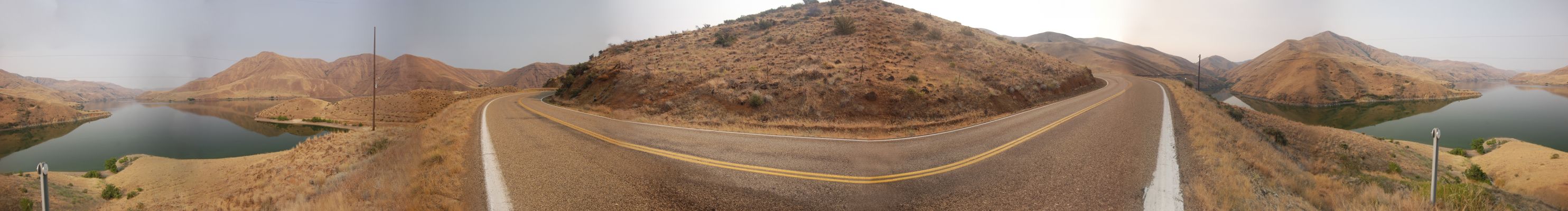
. Unmentioned By The ZMM Narrator
ZMM Route Travelers Go By The Wide Still Water Of The Dammed Up Snake River.
********************
About The Snake River, From Wikipedia =>
The Snake River is a major river in the interior Pacific Northwest region of the United States. About 1,080 miles (1,740 km) long, it is the largest tributary of the Columbia River, which is the largest North American river that empties into the Pacific Ocean. Beginning in Yellowstone National Park, western Wyoming, it flows across the arid Snake River Plain of southern Idaho, the rugged Hells Canyon on the borders of Idaho, Oregon and Washington, and finally the rolling Palouse Hills of southeast Washington. It joins the Columbia River just downstream from the Tri-Cities, Washington, in the southern Columbia Basin.
The river's watershed, which drains parts of six U.S. states, is situated between the Rocky Mountains to the north and east, the Great Basin to the south, and the Blue Mountains and Oregon high desert to the west. The region has a long history of volcanism; millions of years ago, Columbia River basalts covered vast areas of the western Snake River watershed, while the Snake River Plain was a product of the Yellowstone volcanic hotspot. The river was further altered by catastrophic flooding in the most recent Ice Age, which created such features as the Snake River Canyon and Shoshone Falls.
Click Here For ThIs Compete Wikipedia Page, With 4 Maps And 18 Dramatic Photos.
File = DSC 0299 PanoSnakeRiverFromBluff Resize2968x400