Saturday, July 20, 2024:
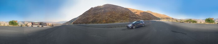
Continued From Previous Photo => We Go Into A Historical Marker Turnout => Here, Despite The Tree Leaves Covering The Idaho Historical Marker 327, We Can See It Tells About The Newer US-95 We Have Been Traveling, For The Last Several Miles, and About The Older US-95, Called White Bird Grade. We Stop To Study All This In, AND =>
Then, As Seen /\Above/\, Further To The Right, We ALSO Take In, The Adjacent Covered Kiosk Shelter With Three National Park Service Information Displays About => White Bird Battlefield And The Nez Perce National Historical Park, Which Will Be Shown & Discussed In The NEXT FOUR Photos.
Along The Newer US-95, About 10.4 Miles SouthWest of Grangeville, ID.
As Partly Seen In Above Photo => The Text Of Idaho Historical Marker 327 Says =>
For 60 years after construction was completed in 1915, White Bird Grade (Seen From Here, Across the Valley) served Idahos only north-south highway.
Many tortuous curves and switchbacks -which, if placed together, made 37 complete circles - let the old road climb 2900 feet in 14 miles. Gaining an elevation of 4429 at its summit, that route represented a significant engineering and construction achievement. This new grade did not replace it until 1975.
Click Here For More Information & Photos Concerning This Historical Marker.
Wikipedia Has A Good Photo & Map. And Says => The White Bird Grade Click Here. is a historic mountain highway along a former section of U.S. Route 95 near White Bird, Idaho, United States. It is listed on the National Register of Historic Places as an engineering accomplishment, a "marvel" which was an achievement of the early good roads movement.
This highway in Idaho County was built 104 years ago in 1920 and upgraded through 1938. Its 1974 NRHP nomination asserts that it "will be remembered as one of the marvels of highway engineering, built when cars did not travel much more than 25 miles per hour (40 km/h)." At the time, a more modern highway was being built through the area.[2] and it opened in June 1975.
The contract for the original road, 22 miles (35 km) from the mouth of White Bird Creek at the Salmon River to Grangeville, was awarded in late 1918.[8] Completed in 1921 and first paved in 1938, it rose slightly higher to 4,429 feet (1,350 m), due to the absence of a summit cut. Located to the east, the old road was twice the length and had a multitude of switchbacks ascending a treeless slope.>
.Farmers kept water troughs at a few of the precarious switchbacks for their livestock and folks who frequently traveled the road knew their exact locations, as they were a welcome stop for over-heated cars. Some log trucks would exit the new N US-95 in White Bird and take the old narrow, switchback riddled US 95 since the grade was spread out over about 4 extra miles making it much easier on those trucks hauling heavy loads over the grade. There is an annual charity "Just For the Hill of It" bike challenge up the old White Bird Grade.
Wikipedia Has More Details => White Bird Hill Summit. Click Here.
NOTE: See The NEXT PHOTO Shows The FIRST OF FOUR National Park Service Displays, Which Are About The White Bird Battlefield & History.
File = DSC 0031 (1)-Panorama Resize400x1948