Looking Back (North), At The Road We Have Just Come Down.
Just Right Of Center, The Whole Distant Mountain Sides Are One of the Many Nez Perce National Historical Parks.
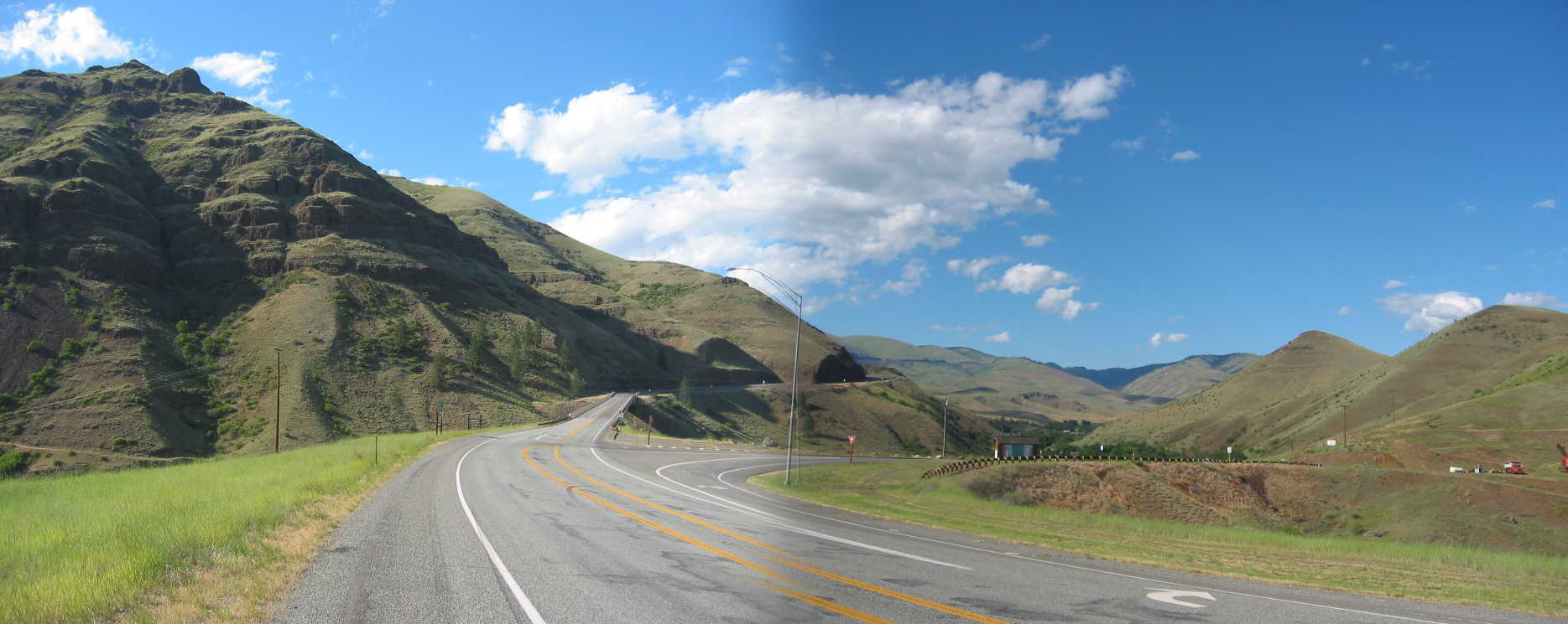
Looking Closely, You See After The Foreground, What Looks Like A Minor Dip In The Highway. Although Not Evident, At The Dip, The Highway Goes Over Very High Expensive Bridge, Over The Huge Canyon Of White Bird Creek! Also the Older US-95 (which was traveled by Robert Pirsig in 1968), goes West under this bridge, as it follows White Bird Creek, to where fit lows into the Salmon River.
A Dramatic View This Will Seen In THIRD NEXT Photo.
.I look back over my shoulder and see antlike cars way back at the top. (Cont. Next)
One mile South of White Bird, ID. When I was here, I looked in vain for roads that would lead to the locations of The Narrators 1968
I see our road will go down and down through what must be a hundred hairpin turns
. .
.But with a printed topo map in hand, it should be easy for anyone to find, the needed road(s to do this.
The 2nd next photo will additionally discuss the Narrators Road to White Bird Hill using the old twisty hairpin curved road.
..****************..
To see both the Narrators old twisty hairpin curved Gravel Road and The Newer Highway, US-95, on a Topographic (Topo) Map, Click Here => RIGHT CLICK AND SELECT NEW TAB => AFTER Map View Comes Up, You Will See a Clutter of Adverts That Are Impossible To Eliminate => YOU BEST SHOULD => .
.Use Scroll Bar At Far Right => Adjust Green Topo Map Until You See JUST BELOW The Plus&Minus At Upper Left => A ClickOn For Full Screen. Click On It, And Adverts Will Be GONE. => >
.Then use Plus&Minus To Zoom. You can Click&Drag Map In Any Direction, To See More Off Your Screen Edges.
..****************..
Once The Above Blue Link Is Up, And Clicked For Full Screen, You Should Be Able To See =>
A) At Far Left the Blue Salmon River along which further South, The ZMM Route, on US-95 will follow.
B) At center, The Nez Perce National Historical Park, surrounded by a Bold Red-Brown Border.
C) A bit left of the Bold Red-Brown Border, the Narrow Dark Line is the Newer Highway, US-95.
D) Just Right of the Upper Part of the Border, you will see Narrow Double Line of the older US-95, which is the Narrators 1968 road =>
I see our road will go down and down through what must be a hundred hairpin turns
.
E) Close study of either end of the Narrow Double Line, should reveal how to find, the connecting road(s), needed to actually access & travel the Narrators old twisty hairpin curved road.
*************************
(Photo = 111-1131 + 1sc ...... ZMM Page = 259 ...... WayPt = 283x 1732ft)