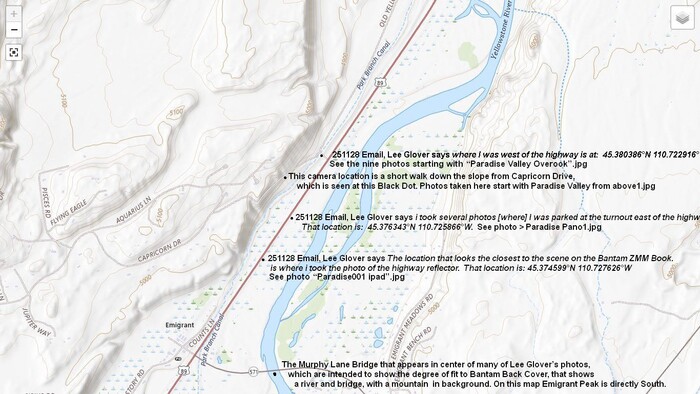
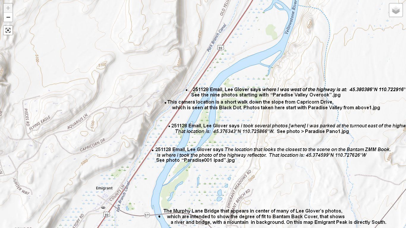
A TopoZone Map Showing The Same Area As The PREVIOUS Satellite View Photo, AND Has Marked The Same 4 Important Camera Location Points, Where Lee Glover Took His 22 Photos => Shown & Discussed In This Photo Album, Following.
It Surely Will Be A Rewarding Task To Get Good Photos Of => The Mountain, & River, & Bridge Part Of The Scene, Shown On The Back Cover Of The Bantam New Age Edition: And Certainly Worth The Effort.
********************
General Considerations For Taking Photos => That Are A Best Fit To The Back Cover Of The Bantam New Age Edition, Of ZMM Book.
1) Take earlier photo shots at locations, which are NOT the estimated best locations. This way, the earlier shots, are a practice for the following shots, for which you want to be in your best Quality State Of Mind.
2) Of course, to get a Best Fit To The Back Cover, will need to move around to get a useful camera vantage point, which has => The view of the River + Bridge, which are correctly aligned with the slopes on the Right Flank of Emigrant Peak, in the background..
3) When arrive at any one Camera location Point, because of trees, it is NOT likely to see both the river & bridge, as shown ZMM Back Cover.
. Of course, here starts the arduous job of finding places where a shot will have both the bridge with the river close to the left.
4) On the /\above/\ TopoZone Map, potential Camera Points are marked wherever you see a Black Dot + Examination..
5) Extensive exploration with Google Street View, shows that => Any photo taken from along highway US-89, will mostly NOT have a full view of the Yellowstone River (or Bridge), because there is not enough elevation for a view of the river, above the many trees.
6) A good place to gain the necessary elevation, AND have the correct alignment of the River + Bridge, with the slopes on the Right Flank of Emigrant Peak => Starting at the above TopoAone Map, marked Black Dot + Examination.saying Paradise Valley Overlook, then From Canal Crossover Road, walk Southwest along the Capricorn Drive, which will climb UP the slope => To high enough elevation, so the river and bridge, can be seen without being blocked by trees.
File = ScrnCpt TopoZoneMap Emigrant.MT Low&HigherElevationCameraVantatePoints1thru5MoTx.jpg