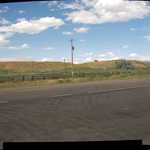
ContFmPreviousPhoto => A Partial & INADEQUATE Panorama View Of => Northward Hills of Yellowstone River Valley.
One Mile North of Yellowstone River, on US 12, At Forsyth, MT. .The /\ Above /\ 3 Photo Pano opens looking A Northwest over US 12 To The Low Hills of The North Side Of The Yellowstone River Valley. And scrolling to right, you see the shade trees, and then The Road Ahead, in Henry Gurrs direction of travel Southeast toward Forsyth MT:
.************** .
NOTE => The /\ Above /\ Panorama Photo Shows Only 3 Of The SAME CAMERA PHOTOS (And SAME Physical Location), As Previous Hi Quality Panorama Photo, But Stitched. By Less Than Perfect Efforts of Henry Gurr, Using Available APPs.
..AND the /\ Above /\ Photo Is Kept Here, So You may See The Difference. .Which as you can see in the /\ Above /\, the Photographic Quality is acceptable, but The Less Than Perfect Stitching Of Henry Gurr failed to include 4 of the 7 Photos supplied. This is because APPs Henry Gurr used (in /\ Above /\ Autostitch), would Only assemble 3 of the 7 photos supplied. Ultimately caused by Henry Gurrs inadequate Panorama Photographing Technique. The Previous Panorama Photo Stitched & Edit Improved by FlatWorld.com is Far Better.
This Google Street View, will allow you to drive Southeast, to experience the landscape, and after ~one mile, view the Yellowstone River, and edges of .the town. .************** .
Cont Next.Phot => Rosebud County Library, Forsyth, MT
Photo File = DSC_0526-0528}AutostitchMk~150deg.jpg Posted 4 June 2020, Revised 14 Oct & 5 Nov 2020.
| File size | : | 3027573 bytes |
| File date | : | 2020:06:04 13:45:38 |
| Date/Time | : | 2020:05:17 17:19:32 |
| Resolution | : | 8182 x 2212 |
| JPEG Quality | : | 90 |