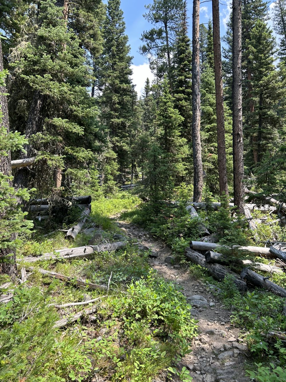
A Good Place For The ZMM Narrator And Chris To Stop For A Rest.
. We stop for a rest, sit down and brace against a tree so that we dont topple over backward from the packs. After a while I reach around over my shoulder, take the machete from the top of my pack and hand it to Chris.
"See those two aspens over there? The straight ones? At the edge?" I point to them. "Cut those down about a foot from the ground."
"Why?"
"Well need them later for hiking sticks and tent poles."
Chris takes the machete, starts to rise but then settles back again. "You cut them," he says.
So I take the machete and go over and cut the poles. They both cut neatly in one swing, except for the final strip of bark, which I sever with the back hook of the machete. Up in the rocks you need the poles for balancing and the pine up above is no good for poles, and this is about the last of the aspen here.
Fox Creek Canyon, After Turnoff From Upper Cottonwood Canyon, Gallatin National Forest, MT.
Here Are More Clues, So Far, As To Where The ZMM Narrator And Chris Have Hiked =>
. a) Although 3 or 4 days for 12 miles, may seem way too much time, perhaps it is a reasonable speed for mountains with steep slopes, especially considering that the Narrator and Chris ( only 11 years old), are carrying heavy packs. Both are out of shape, and must stop often for long rests.
. b) After two days hiking, they will be relatively near a frequently traveled road.
. c) When they turn into a smaller, less traveled canyon, this turns their route away from their snow goal, requiring a later turning back, and continuing upward onto a ridge.
. d). All very important clues, especially the ridge clue, being well above the smaller canyon at this point.
NOTE:
. Topo Maps, do show in Cottonwood Canyon, where a viewer ~2 miles from the DeWeeses could see => Directly up-canyon, and view a ridge, in the foreground, and beyond the ridge could, see some very high mountains, which would have snow. That this is possible, is confirmed by viewing this in GoogleEarth.
And, as discussed in a previous photo, it is believed that this is the way Author Robert Pirsig, knew to write this idea into ZMM Book.
*******************
(Photo = NC9d.JPG ...... ZMM Page = 173 ...... Photo Simulate WayPt N+C 10 ~6800ft = 4.4 mi fm DeWeese.)