Well AFTER The Fact, The ZMM Narrator Tells Us They Have Turned Off From the Main Trail, and Entered A Seldom Entered Canyon And Have Climbed Enough, That They Are This Far Up .
. This is apparently a seldom-entered canyon this far up.
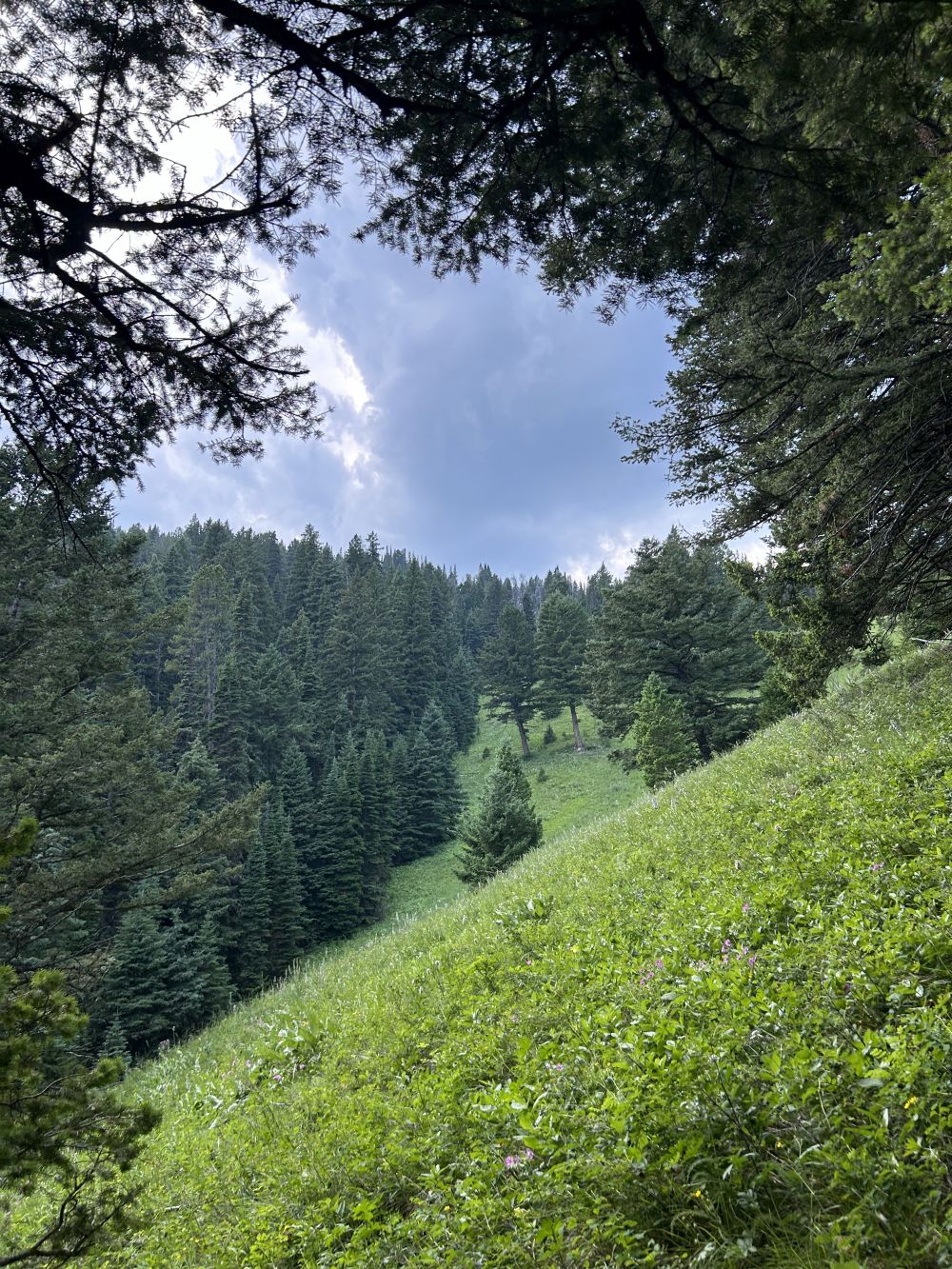
Continuing Moving Up In A Smaller Side Canyon, Off Of Upper Cottonwood Canyon, Gallatin National Forest, MT. Here at this N+C 09 WayPt, my "N+C Hypothetical Climb Trail" shows this turn, into a Smaller Side Canyon, off of Upper Cottonwood Canyon.
The Three Trail Clues Discussed In The Previous Photos, Suggests =>
..a) Because they can soon follow it to its end ", the canyon they enter is likely smaller than the canyon they have been in. AND
..b) The trail shows less use than the trail they have been on and their current trail soon disappears.
.I believe these clues best fit where they enter Fox Creek Canyon, as shown in my "Hypothetical Trail Climbing Map" WayPt = N+C 09 to 10. It is reasonable that this Fox Creek Canyon should also have a trail, because its floor is fairly level and large enough to look inviting. Thus we may suppose hikers on the well-traveled Cottonwood Trail, might turn off, to also explore this Fox Creek Canyon somewhat, and leave a weak trail there.
. This is confirmed by Gallatin National Forest Trail AllTrails Maps, which show an official trail for Cottonwood Canyon, which connects to an official trail going about a mile up along Fox Creek, until the trail turns West to climb to slope to Fox Creek Meadow. Mouse ClickDrag Map To Follow Along Cottonwood Creek & Trail, Until You See Where The Trail Turn East Into Another Canyon.
I have seen other Trail Maps, which show a main trail in Cottonwood Canyon, which continues all the way to Mt. Blackmore and beyond to Hyalite Canyon Campgrounds and public paved roads. These attractions are a destination and a source of a large amount of foot traffic traveling both ways on the Cottonwood Trail.
.Clearly, this Cottonwood Trail is a main trail that would show much more traffic than Fox Creek Canyon Trail, , which fits the ZMM Narrators, seldom-entered side canyon.
In addition to the above-mentioned AllTrails Maps, showing these trails both Cottonwood Canyon, and in Fox Creek Canyon, you may also see these trails in the very good Maps given
in => Caltopo Maps, which also show all 30 N+C WayPoint and Elevations . Click Here.
********************
(Photo =. IMG_0145 Resize1000x1333 ...... ZMM Page = 181 ...... Photo Simulate WayPt = N+C 10d ~6940ft = 4.9 mi fm DeWeese.)