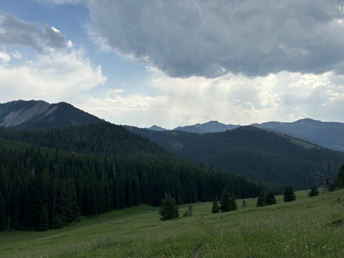
Looking Over Fox Creek Canyon, Storm Clouds And Threat of Rain Are Seen.
. Im ready for a nap, but clouds have formed in the canyon that appear ready to drop rain. Theyve filled in the canyon so that we cant see the bottom and can just barely see the ridge on the other side. .. I break open the packs and get the tent halves out,
Chris & The ZMM Narrator Are At A Higher Up Flat Spot Knoll, On The Side Of A Smaller Canyon, Off Of Cottonwood Canyon, Gallatin National Forest, MT.
The /\ Above /\ Photo, In Real Life, Shows The Upper Part Of Fox Creek Meadow, Which Is a Popular Place To Visit In Gallatin National Forest.
More Information About Fox Creek Meadow.
A). From Tina DeWeese we learn that Robert Pirsig & wife Wendy, along with the DeWeese Family, in June 1990, climbed the trail to be at Fox Creek Meadow. (See INSTRUCTIONS below, for more information and Blue Link to see 2 more photos of the Meadow and the Trail to get there.)
B) The above photo in real life shows Fox Creek Meadow, which is a large area that is, and has been mostly grass, for a very long time. No reason has been found for why and how this meadow does not grow to dense forest, as is seen all around
C) As shown on my Hypothetical Climbing Trail Topo Map, the Narrator's Hypothetical Camping Spot, N+C 12 (in the /\ Above /\ Photo), is at the far left, and is located well beyond the green trees, seen at the left photo side.
The clouds in above photo, are similar to those I observed when I hiked up to Fox Creek Meadow, in Summer 06, and actually had produced a light rain about an hour earlier.
..****************..
.On My Visits Here In Summer 2002 And Summer 2006, the locations I explored are (also) marked on my previously mentioned Hypothetical Climbing Trail Topo Maps. =>. These are at Way Points 215 thru 226, where I observed a few very small trees, but mostly lots of open grass places, which in turn are consistent with logging, and thus NOT candidates for Narrator's campsites.
.This consistent with logging, is in contrast to what I saw at WayPts 407 thru 507, which were not very far away from Fox Creek Meadow, but had dense forests. (Note, not all WayPt numbers in these ranges were used!)
.These latter forests looked like the Narrator's (previous photo described) forest at his "flat spot,
a large knoll protruding from the side of the mountain.: Similar forests are seen in Author Robert Pirsigs 1968 Photo of their tent, as discussed in a previous photo.
.
**************************
INSTRUCTIONS TO SEE MORE PHOTOS OF FOX CREEK MEADOW, AND HIKING TRAIL AND READ ABOUT ROBERT PIRSIGS VISIT THERE.
..1) After you click on the Blue Link below. You will see a page of 18 Small Photos: Please scroll down to, and read words below the 9th, 10th and 11th, small photo.
..) Then, click on any of the small photos to see a larger version. The >> Icons Upper Right or Lower Right, will advance to the next photo.
..) To Best See Panoramas And Other Large Photos, Click Photo Several Times To Get Largest View. Then ClickDrag Sliders To See Parts Off Screen.
Click Here For.=> Two More Photos Of The Meadow And The Trail To Get There Plus Discussion Of What Is There.
*************************
(Photo =.IMG_0129 Resize1333 x1000 JPG ...... ZMM Page = 201 ...... Photo Simulate WayPt = N+C 12cont2 7750ft = 6.2 mi fm DeWeese.)