The Clouds Appearing On the Other Side Of The Canyon, Signal Problems With Chris.
.Also Metaphorically Indicates Problems With The Narrators Working Out His Own Understanding of Quality.
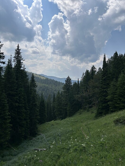
.The New Coolness Makes It Easier Hiking AND Easier For The Narrators Discussion Of Quality .
. "I dont like this trip," he says. "It isnt any fun. I thought it was going to be fun." .. Some anger catches me off guard too. "That may be true," I reply, "but its a hell of a thing to say." .. I see a sudden flick of fear in his eyes as he gets up.
.... We go on.
.... The sky over the other wall of the canyon has become overcast, and the wind in the pines around us has become cool and ominous.
.... At least the coolness makes it easier hiking -- . ..
Continued Climbing The Side Of Fox Creek Canyon, Gallatin National Forest, MT. (GPS = 45.47608 -111.02714 )
Note how the Narrator's clouds warn us of bad things to come, and this is not necessarily the weather! This keeps the reader in suspense, and is one of the Narrator's techniques to keep the reader alert and engaged!
..****************..
. Click here for Google Maps Satellite Overview of Cottonwood Canyon, Fox Creek Canyon, showing => A Trail Partly Following Fox Creek. Unmarked Center of screen is WayPt = N+C 12.
.AFTER Satellite View comes up, ClickDtag gradually to the South and a bit East, and will see at right } Hyalite Reservoir, then Hyalite Creek Trailhead.
. Continue to ClickDrag South, and you will see to center and more left => Mount Blackmore (10,154 ft) and Elephant Mountain (10,085 ft).
..****************..
(Photo = IMG_0119 Resize1000x1333.JPG ...... ZMM Page = 193 ...... Photo Simulate WayPt = N+C 10h 7100ft = 5.3 mi fm DeWeese.)