Just Now, Let Us Take A Moment To Think Further About Chris & The Narrators Climb To This Point. =>
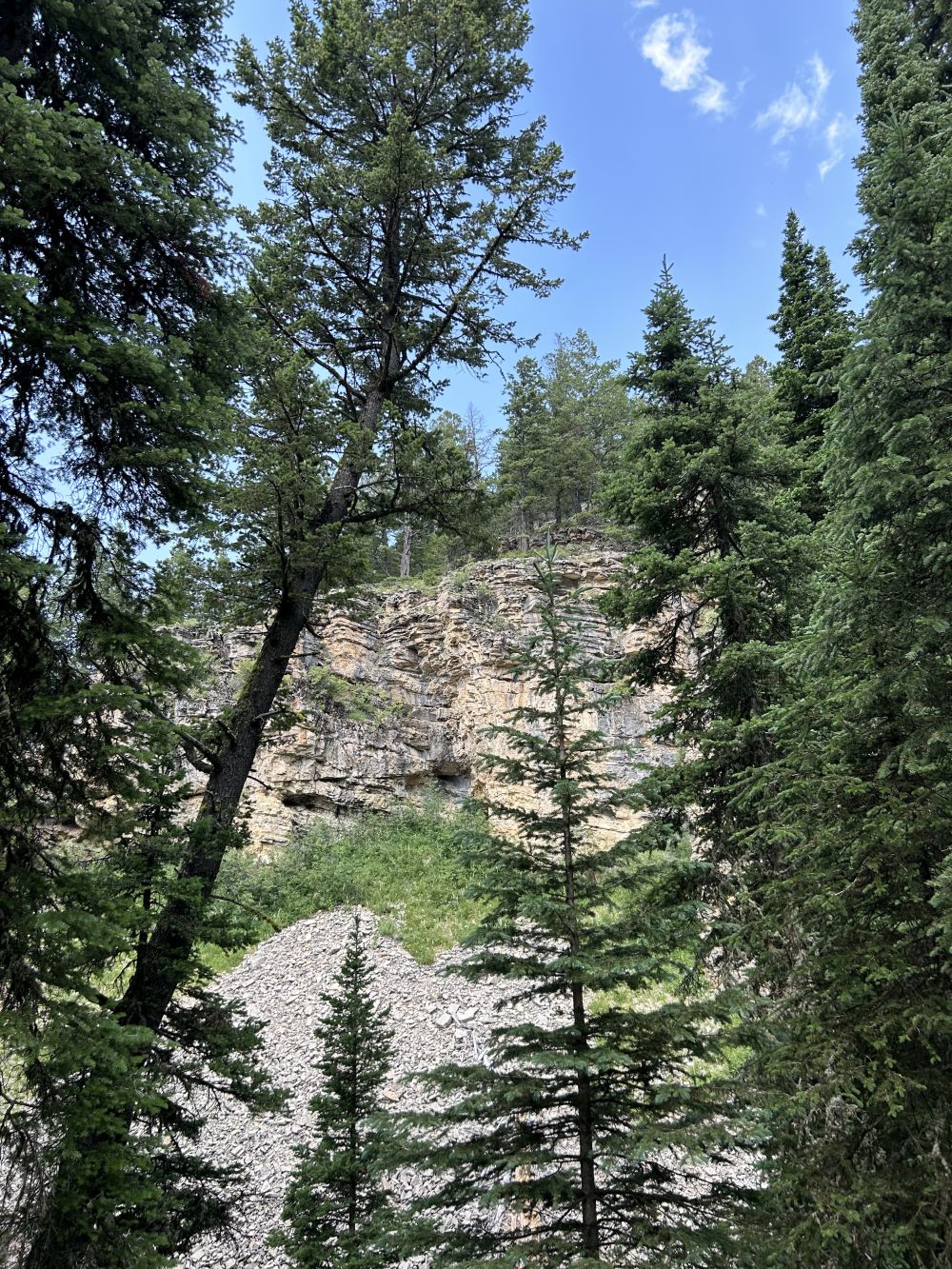
A) The ZMM Narrator Says We Come To A Rough Grade And It Changes To Two Breaths Per Step. At One Bank It Goes To Four Breaths Per Step. Huge Steps, Almost Vertical, Hanging On To Roots And Branches.
B) Which Is On A Very, Very, Steep Slope, On The Side Of A Smaller Canyon, Off Of Upper Cottonwood Canyon, Gallatin National Forest, MT.
THINKING FURTHER ABOUT NARRATOR & CHRIS MOUNTAIN CLIMB;
...Be sure to notice that the above photo illustrates the ZMM Narrators =>
We Come To A Rough Grade And It Changes To Two Breaths Per Step. At One Bank It Goes To Four Breaths Per Step. Huge Steps, Almost Vertical,.
Similarly. Going Up The Steeper Parts Of Fox Creek Canyon, Soon After WayPt N+C 12, Amateur Mountain Climber, July 17, 2024, Joe Pioro Suddenly Encountered Nearly Impenetrable Forest!
When Mr. Joe Pioro got back from his climb, he right away spoke of the steeper parts of Fox Creek Canyon, he said => Basically I could see it would be exceedingly difficult for me to force further. Here I hit a real barrier. Perhaps, bush whacking a day, might gain the ridge at N+C 15.
Because Mr. Pioro, did not, as did the ZMM Narrator, have a machete from the pack on my back.
.He at this point gave up, found his way back to the History Rock Trail, and used it to go to Hyalite Canyon road to get a ride back to his car, at the Cottonwood Canyon Trail Head.
*************************
NEW TOPIC1: How I DETERMINED The ELEVATIONS For N+C WayPoints (At The Bottom Of Each Caption Line) For This Photo Album.
A) With Thanks to TopoZone.com
.. See NEXT Photo For Instructions How To Use TopoZone.com
B) With Thanks to CalTopo.com
..CalTopo Is Excellent For Working With Topo Maps, GPS WayPoint Data, And To Study & Explore Mountain Climbing Routes, Especially In Gallatin National Forest (GNF), South Of Bozeman, MT.
CalTopo, an excellent on line platform, and is shown here because, again and again, I keep finding more and more uses for its abilities!
Even for changing GPS Waypoint Data.gps to .KLM, for loading WayPoints into Google Earth.
. ALSO, I have Used Caltopo To Display On A Topo Map, All 30 N+C WayPoints With Corresponding Descriptions AND Find N+C WayPoint ELEVATIONS. Click Here.
*************************
(Photo = IMG_0111 Resize1000x1333.JPG ...... ZMM Page = 201 ...... Photo Simulate Photo Simulate WayPt = N+C N+C 12cont3 7800ft 6.4 mi fm DeWeese.)