The Narrator Reaches A Cliff and Moves Along It, In Search Of A Way Down.
.Then they Hear The Roar Of A Much Larger Creek In The Distance.
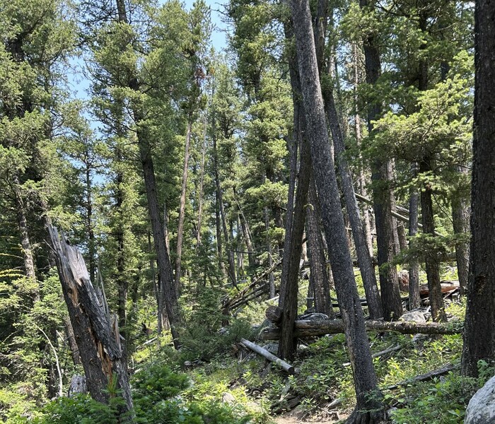
.We reach a cliff, angle along its edge in search of a way down, and eventually a narrow draw appears which were able to descend. It continues down through a rocky crevice in which there is a little rivulet. Shrubs and rocks and muck and roots of huge trees watered by the rivulet fill the crevice. Then we cross
In A Rocky Crevice, Just Above Hyalite Creek, Gallatin National Forest, MT. Note many location clues as to where this route should be. For example, the ZMM Narrator says they reach a cliff and it is bad enough that they must move along it in search of a way down.
.Although the previous WayPtsN+C, I have shown on my "N+C Hypothetical Climb Trail" map, fit very well to the ZMM Narrative, the route up, by contrast, the route from the Crest of the Narrators Ridge to Hyalite Creek, offers many very different reasonable routes down to the nearest road. Thus, there may be "N+C Hypothetical Climb Trails", that better fit the ZMM Climb Narrative, than the one I have shown.
.As previously mentioned: A complete field study is needed, to determine a good route, from WayPt N+C 26, to N+C 29, and then decide the final "N+C Hypothetical Climb Trail, from on-on-site field study.
.An inexperienced person, not having a topo map, might well stumble onto a cliff, like the Narrators. There are plenty over this way. But the Narrator, even in his emotional condition, should have been able to avoid such a disaster! Even better, prior route planning for less difficult routs, should bave been done.
But of course, it is more likely that Author Robert Pirsig, adds these gruesome mucky details, to beef up the sheer climbing difficulty, when he adds to his narrative, this => We reach a cliff, angle along its edge in search of a way down,
Shrubs and rocks and muck and roots of huge trees watered by the rivulet fill the crevice.
.My Hypothetical Climbing Trail Map (discussed in these photos), essentially shows a bumbling idiot's way down. And includes a rugged cliff, that is close enough to a major mountain stream, to hear its roar. This is of course upper Hyalite Creek.
*************************
(Photo = IMG_0094 SelectPartWithOpeningsBetweenTrees Resize1166x1000 ...... ZMM Page = 230 & 231 ...... Photo simulate WayPt = N+C 28 8200ft = 10.3 mi fm DeWeese.)