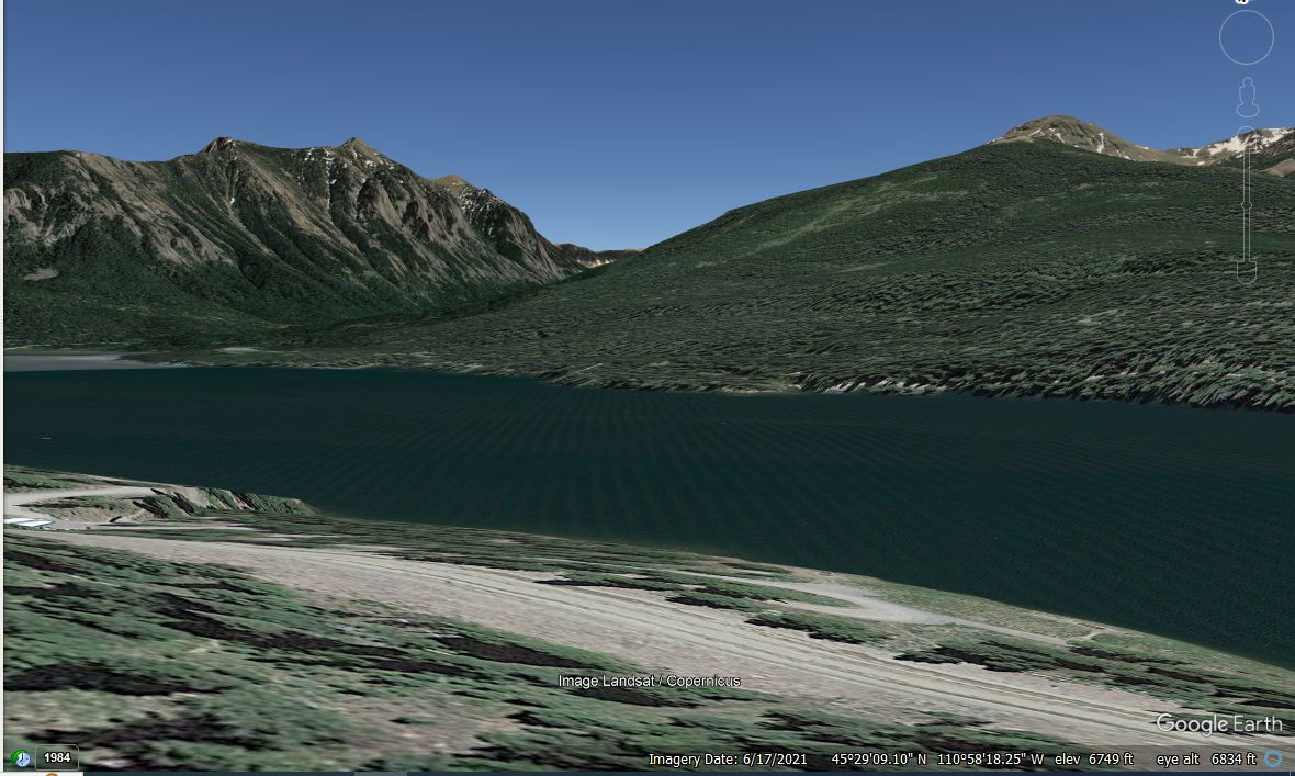
A Google Earth View Of Scenery, Frist Attempt By Henry Gurr, To Scene Match The Background Scenery Of Tom Zitos 1974 Photo Of Robert Pirsig.
You Can See The Road By The Edge Of The Water Of Hyalite Reservoir, And The Mountains Beyond
Gallatin National Forest, Ten Miles South Of Bozeman, MT.
.
Assuming that the above-mentioned Tom Zito photo was taken close to the Langohr Campground, leads to looking at the nearest large body of water, called Hyalite Reservoir.
At first I tried Google Street View, since they see to have captured nearly all streets, and shows ground level scene, same as Tom Zitos 1974 Photo. Although Google Street View, shows all of lower Hyalite Canyon, their capture unfortunately stops 6.5miles short of Hyalite Reservoir, at Practice Rock: Trail Head Parking Lot. Click Here.
******************
Since Google Street View did not go far enough, I used Google Earth Pro, already installed in my computer, to show Hyalite Reservoir, and then rotate scene to what I then thought was as close as possible to the mountains shown in Tom Zitos 1974 Photo. You see the result in Above /\ Photo.
However the top edge of the mountains, dont fit well enough those mountains shown in Tom Zitos 1974 Photo Of Robert Pirsig. Nor in the right foreground is there any land with plants and low bushes, as is shown in Tom Zitos 1974 Photo.
******************
The next photo, shows Henry Gurrs second Google Earth attempt to match the background scenery of Tom Zitos 1974 Photo Of Robert Pirsig.
For All Photos In ZMMQ Gallery, Please Remember Previous Instructions => FOR BEST GALLERY PHOTO VIEWING =>
For The Convenience Of The Reader, The Following Is Duplicated From Previous Photo.
. The Tom Zito Article Click Here, said " About a week into our journey, he [Pirsig] warmed to the idea of being photographed in the mountains where he was working on his next book, and this is the result.. *************************
(Photo = GE MidNeShoreHyaliteLakeMT TomZitoSezRpWarnIideaPhotodMountainsWhereWrkNexBook...... ZMM Page = NA ...... WayPt = NA )
