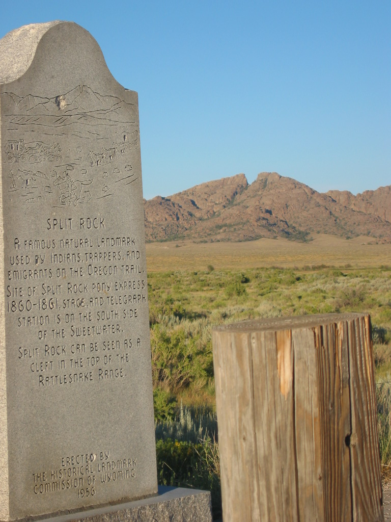
Historic Monuments Along Oregon and California Trails in Central Wyoming. Looking East, You Can See "Split Rock" In the Distance.
On Rt287, about 10 miles East of Jeffery City, WY. Traveling On Route 287,( ~90 miles back) I saw the rightly notorious South Pass. This was a jagged forest of rocks which the Oregon Trail Emigrants had to negotiate to get over the high mountains of West Central Wyoming. This was both the Western Continental Divide and the highest altitude elevation of the Oregon Trail. (Donner Pass in California, at 7897 feet, on the California Trail, however, was higher!) This continuous mountain range (barrier to Western Migration) runs practically from Canada to Mexico. There are many web pages that show great photos of the whole South Pass segment. Send me an email if you want me to send Web Addresses of these sites.
************************************
(Photo = 125-2596 ...... ZMM Page = None ...... WayPt = 124 6229ft)