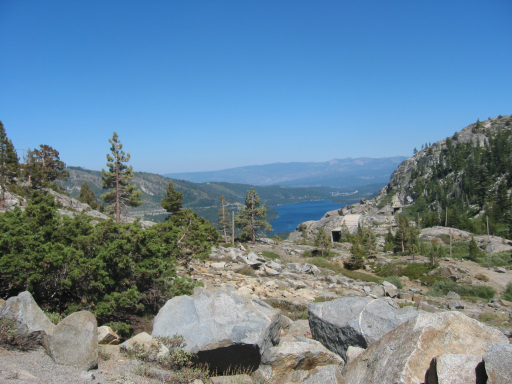
Donner Pass Looking East: Granite Rock Field, Rail Road Tunnel Entrance, and in the distance Donner Lake.
Donner Pass, CA. This is one of the several routes of the pioneer "California Trail" over the High Sierras. The covered wagons came up a practically vertical granite cliff just beyond the rocks and then had to negotiate around and over the rocks you see everywhere here. In the distance towards center you can see the tunnel entrance of the original (first) Trans-Continental RR. The main Interstate over the Sierras from Sacramento to Nevada parallels the former Historic California Trail and Donner Pass, several miles North of here. I was able to drive over Donner Pass on the once=upon-a-time main highway which I believe was old Rt40 & Rt95. This road still serves as a marginal road for the California Trail towns of Gold Hill, Cisco, Soda Springs, Norden, and Trukee. The old highway is well maintained and is a very scenic tourist route and access to a mountain ski lift at Donner Pass. But you will have to study your map and look hard to figure out how to find it. Lake Tahoe is about 30 miles Southeast of Donnor Pass. The otherwise arrow straight CaliforniaNevada border takes a dog-leg change of direction in the middle of Lake Tahoe.
************************************
(Photo = 122-2296 ...... ZMM Page = None ...... WayPt = 075 7150ft. My Rand McNally gives 7089 ft)
