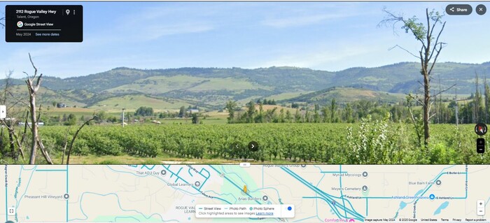
Scenery Along The Rogue Valley Highway, Rt-99. A Second View Of A Lush, Green, Exquisite, Beautiful Valley!
Above Is Seen What Again, Looks Like A Vineyard, Which Runs From The Highway, All The Way To Bear Creek, Which Is In The Lowest Area, This Side Of The Distant Mountains.
However, Looking Closely, It Is Seen That => The Rows Of Thick Green Foliage, Are Much Wider Than A Typical Vineyard. And Below The Thick Green Foliage, Are Seen Tree Trunks, Spaced About 5 Feet Apart.
Thus, This Is More Likely An Apple Orchard, Or Peaches, Or Similar.
NOTE: Starting At The Previously Mentioned => A Steeper Descent Down To Schoolhouse Creek Valley, and continuing all along Rt-66 thru Ashland, Oregon plus 50 miles along Rt-99 Northwest of Ashland, Henry Gurr used Google Street View, to look close for any evidence of Author Robert Pirsigs Vinyards. Here and the previous photo, are the ONLY places where, what looks like a vineyard, is seen.
ZMM Page ~317
File = ScrnCpt GSV 2ndVuVineyardFmRt99ToBearCreekMoNwOFAshlandOR SeeWonderfulMountainsInDist