Yup!! Here Is the Railroad Underpass Just Where the Narrator Said It Was!
.Turn South Here, To Follow US-212 ZMM Route to ZMM Town of Red Lodge, MT.
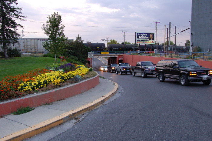
. We meet John again and its settled. Soon, beyond a railroad underpass,
..
Central Business District, Main Street, Laurel, MT. The ZMM Narrators underpass is just a block West of the Old Owl Restaurant Location. As was the case for me in 2002, it is easy to miss the left turn South onto US-212, and turn onto the road to Red Lodge, MT.
.AND due to inattention to above ZMM Passage, I missed taking this /\ Above /\ Photo which had to wait until I returned here in 2006.
HISTORY OF RED LODGE, MONTANA: COAL MINES, RAILROAD, & THE ORIGINAL ROAD TO RED LODGE.
..A) At first Red Lodge, MT, Grew Up As A Mining Camp For Nearby Coal Mines. I conjecture that this road from Laurel, MT (a Major Railroad Junction) to Red Lodge, MT (an eventual Coal Mining Rail Head)
was originally scouted by following Rock Creek to The Mines. The stream would provide water and fodder along the stream for draft animals used in the original opening this area. These Coal Mines, provided the Motive Energy for over 60 years of early Montana Railroad Steam Engines.
. This Rock Creek emerges as very important to the ZMM Narrator, as you will see in Forthcoming Photos, where we are repeatedly told => Following a creek to its source.:
.The original road (now US-212), To The Mines, Following a creek to its source., was aimed directly at the mountains behind Red Lodge, MT.
..B) Red Lodge: A Coal Town On Rock Creek, Which Is A Branch of The Clarks Fork River. Posted on September 19, 2015 ((Concerning The original road, which is now US-212. ))
.When the Northern Pacific Railroad entered the Yellowstone Valley in the 1880s, officials and investors immediately began the search to find and acquire locally available deposits of coal [to fuel their Railroad Steam Locomotives]. First there came the Klein mines north of Billings and then by the end of the decade, the first [next] move toward mines to the south, in the Clarks Fork Valley, at what would become Carbon County with its major town of Red Lodge.
.Development began slowly, with the Depression of 1893 intervening, but as the eras financial and railroad magnates combined the Great Northern, the Burlington Route, and the Northern Pacific into one huge co-operative venture, they selected a new place in the Yellowstone Valley, a town called Laurel at the confluence of the Clarks Fork and Yellowstone rivers, to connect the three railroads. In short order, a Northern Pacific Railroad spur line was built down the Clarks Fork to the place called Red Lodge. U.S. Highway 212 follows this route, and the boom was on.
Entering Red Lodge from the north via US-212 you encounter immediately the towns roots as a railroad town, as the historic Northern Pacific Depot [Building] remains rooted at the head of the town. Here is where my [Carroll VanWest] long-interest with the Red Lodge story began in 1984, when I met with a small group of local historians, preservationists, and civic leaders determined to keep Red Lodge and its still intact historic environment together. The groups vision for the depot was for it to be a visitor center, an arts center, but more than anything a community center, a visible sign of the turnaround that could happen. Already, at the head of town [town entrance], artist Peter Toth had begun the new tradition with his mammoth [Native American People] wood sculpture, In Honor of a Proud and Noble People, [ installed in 1979, a theme of the region .. ] This Article by Carroll VanWest.Click Here.
..****..
.Click Here, For REMAINDER of Article, and Lots of Really Good Photos.
.**************
In The 17th NEXT Photo, you can read about => How to see a photo of The Life Sized Bronze Sculpture Horse Mounted Native American, Which Is In A Red Lodge MT City Park, At The Towns Northern Entrance.
.**************
. ALSO Click Here For A Very Interesting, VERY LONG Article, With Even MORE Really Good Photos, Which Happens To Have ALL of the Article (and photos) Of Above Blue Link.
************
.C) History & Geology of Coal Mines, Related To Red Lodge and Bear Creek Area.
.Late 19th Early 20th Century Underground Coal Development At The Northeastern Corner Of The Beartooth Mountains. .
. [ For The Visitor => ] A journey into the northwestern Bighorn Basin characterized by Tertiary coal beds, train-fueled development, and a large immigrant population. The eventual closure of the mines led to the abandonment of communities and the transformation of historic Red Lodge into a recreational gateway town to the Beartooth Mountains and Yellowstone National Park.
Click Here, For Remainder of Article, and Lots of Really Good Photos & Geology Diagrams.
*************************
(Photo = Summer2006 0399 ...... ZMM Page = 105 ...... WayPt = 123i)