Now We See Why the Beartooth is So Famous
The forests return. We move among rocks and lakes and trees now, taking beautiful turns and curves of the road.
.I want to talk about another kind of high country now in the world of thought, which in some ways, for me at least, seems to parallel or produce feelings similar to this, and call it the high country of the mind.
.If all of human knowledge, everything thats known, is believed to be an enormous hierarchic structure, then the high country of the mind is found at the uppermost reaches of this structure in the most general, the most abstract considerations of all.
.Few people travel here. Theres no real profit to be made from wandering through it, yet like this high country of the material world all around us, it has its own austere beauty that to some people makes the hardships of traveling through it seem worthwhile.. [Cont next.]
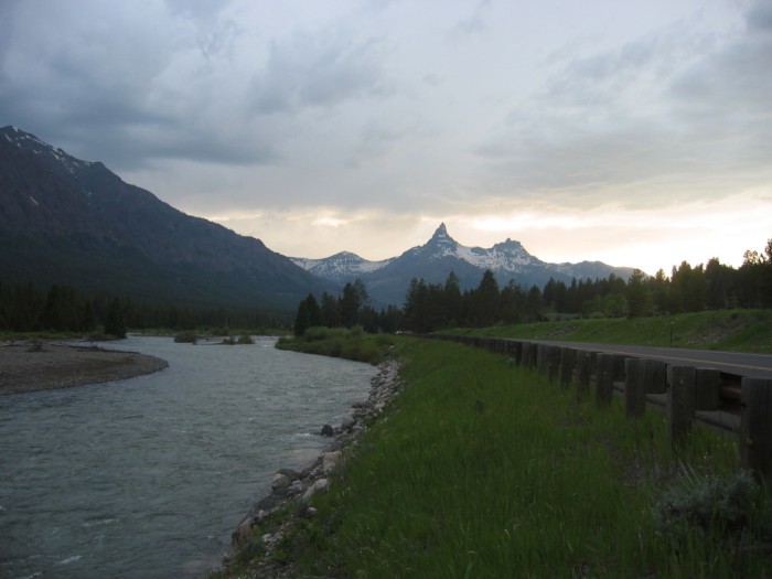
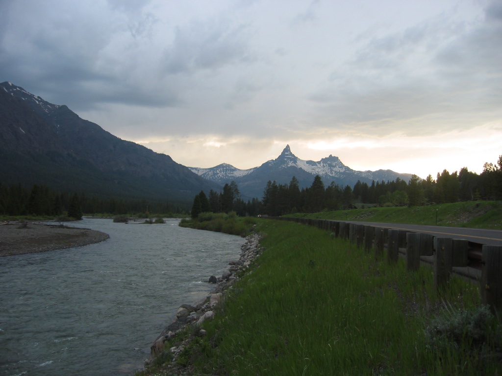
Beartooth Highway, WY. Beautiful mountain valleys. Finally the road is level. The curves are gentle now.
In /\ Above /\ Photo you see my first real photograph of the famous local landmark, Beartooth Mountain. The twin peaks of this mountain have curved sides and very sharp jagged peaks. This helps create the impression of a Beartooth.
You will come to appreciate this curved sides and very sharp peak is the mountain shape of most high mountain peaks, that are subjected to deep snow and glaciation.
.The curved shape is created by the deep snow and ice (with embedded rocks) sliding down the mountain side, and grinding off the mountain sides until steep slopes are created at the top, eventually leaving a Sharp Peak, just like sharpening a knife!
.If this goes on long enough, the sharp point is finally created, similar to the sharpening of a dull knife, you have to keep grinding till the sharp is what is left over! AND the sides are curved because the rocks further down, push the grinding show & ice outward, so the grinding is changed to a lesser slope. Thus the slope curves outward
. Hence the curved sides.
*************************
(Photo = 106-0649 ...... ZMM Page = 111 ...... WayPt = 151w= GPS = 44.934914 -109.757264 ) << [DATE-Line April 12, 2021 This coordinate # is picked off of Goog Sat at reasonable place close to bottom line below, and fits Road and Stream location as close by road at place where should be re photo. (GoogEarth show WayPt 151 >> positioned re road and stream somewhat close to Ie above GPS #s fits on Satellite View >>
1553 US-212, Cody, WY 82414, 44.934914, -109.757264)
.EastGPS finds coordinates below, but seems ~1000ft wrong compared to stream.
...Photo = WayPt = 151w = GPS = 44.92455 -109.74675)