The Road Is Climbing The Hogback Formation To The ZMM Narrators Summit.
.A View Four Minutes After And One Tier Up From The ZMM Narrators Twin Walls of Snow
.Standing On The Fourth Tier, Looking DOWN & A Bit East of North, Two More Tiers And One Switchback Are Seen
.[Then the tunnel opens onto dark sky again and when we emerge we see
. ]
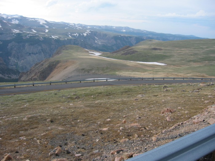
Steep Slope On Hogback Formation, Beartooth Highway, WY. The Narrator omits any mention of the Four Switchbacks and Five Tiers on the Hogback Formation. .
.Despite this, I thought you should see this /\ Above /\ Photo, and the Next Four Photos of the scenery on the way to A Factual Altitude Climax for the Narrators Summit of his High Country. .
Here, On The Fourth Tier Up, We See A Scene Similar The Narrators When We Emerge We See
.,
.The upper half of /\ Above /\ Photo shows the landscape & distant Upper Rock Creek "Gorge" : This is a view similar to what our ZMM Riders may have seen immediately after emerging from the Twin Snow Banks. I believe the tunnel of snow is out of view, to the right of the /\ Above /\ Photo.
.Standing on this higher Fourth Tier, we see the long grey curve of Third Tier next down. And then looking carefully thru the Guard Rail of this Third Tier, you see a patch of white snow and the short grey curve of the Switchback and Second Tier.
For the ZMM Traveler arriving onto the Hogback, this is the First Switchback they would see.
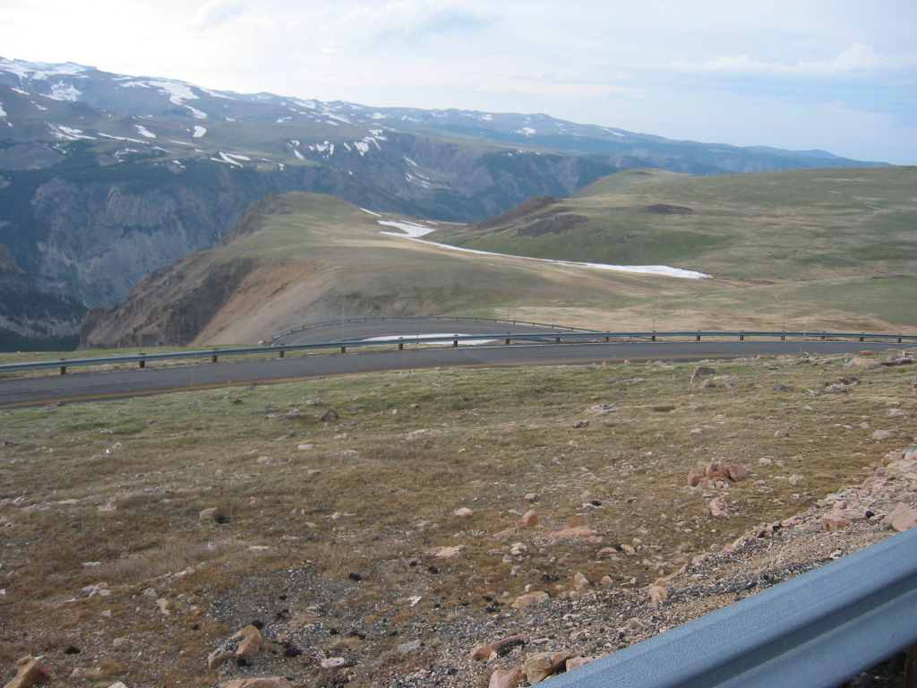
.The /\ Above /\ Photo gives a good view of the distant Upper Rock Creek "Gorge" , and is a view very similar to the Google Street View which was the SECOND Previous Photo:
.These two Views of course look a lot like the Previous Ski Lift Photo, where the. Narrator says I look over my shoulder for one last view of the gorge. .
EXPLANATION:
As Discussed Above, It Is Indeed Possible To See The Narrators "Gorge" , From The Hogback Formation.
. Thus, factually the Ski Lift Area is NOT one last view of the gorge. . This is because (as shown in the /\ Above /\ Photo), you can indeed see the upper reaches of Rock Creek Gorge / Canyon in the Far Distance:
.However, when a traveler is actually ON the Hogback Formation, it is not so obvious that Rock Creek "Gorge" " Is seen in the distance (as technical matter of fact).
The /\ Above /\ Photo Showing The Narrators =>
.. When We Emerge We SEE
., Of Course, Also Reminds Us Of =>
..A) Those Previous Photos (after Red Lodge) which showed the 5 Zig-Zag Switch-Backs up to the Rest Area Turn Out.
(( In the /\ Above /\ Photo these Zig-Zags are down valley to the right, some 18 miles as the crow flies.))
..B) AND reminds us of Previous Photos where Up valley is trending Southwest to central Yellowstone National Park some 80 miles by the same measure. Of course, the distance by road is considerably greater!
((In the /\ Above /\ Photo these up valley to NYP are to the left.))
To See A GSV from Top Of Hogback, On Fifth Tier
AND Then Do Your Own GSV Drive South To See The Narrators High Country => RIGHT CLICK AND SELECT NEW TAB =>
After Google Street View (GSV) Comes Up, Then =>
..1) On This GSV Fifth Tier => Study carefully to see Tiers 4 & 3, then look close between the poles (further down) to see a small strip of Grey that is the First Tier. THEN to the left, you can discern the Switchback Curve of this Tier.
Be sure you are finished THEN =>
..2) Click the Google Street View Image WHERE you want the VIEW To go. => At any time, you can Click On The Plus & Minus To Zoom AND You can ClickDrag the Image On Screen in any direction for a better view
.AND, Moving South, A Continuing View Of The Narrators Summit & High Country .
*************************
(Photo = 106-0627 ...... ZMM Page = 110 ...... WayPt = 143w)