Finally
There It Is! =>
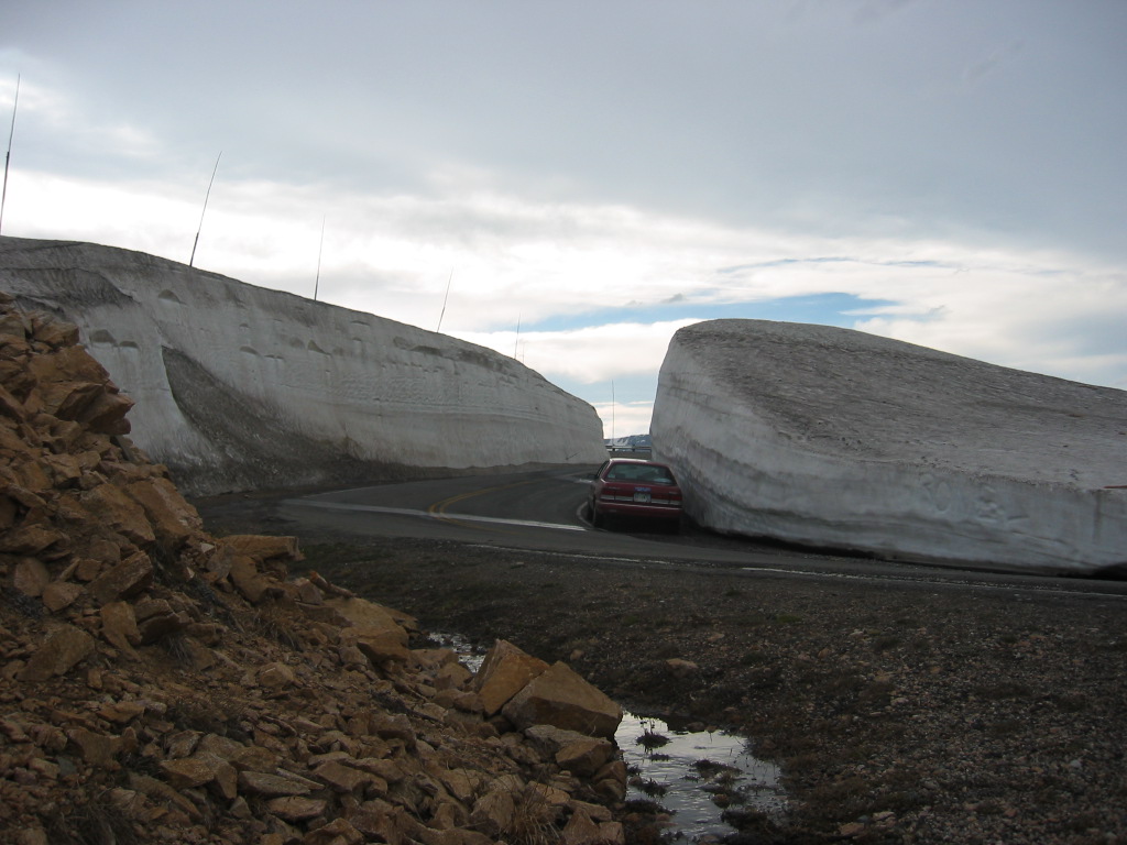
The ZMM Narrators Twin Walls of Snow. View Southwest.
...Made From Trees The Tall Wooden Poles Help Guide The Snow Plows Not To Lose The Pavement.
.. We move through twin walls, almost a tunnel of snow.
ZMM Route, Second Major Snow Fields, Beartooth Highway, WY. Elevation is 10,736 feet.
.In the /\ Above /\ Photo => Note grass and mud in melt water stream, along pavement. In these high elevations of the Beartooth Plateau, there is generally very little topsoil, as may be seen in the rocks piled from road construction bulldozers most places along the road. Thus it takes some flowing water to make a collection of mud.
.As stated in Previous Photos => The deep snow here is => Apparently, local snow drop-out from the strong NW wind coming up the adjacent steep slopes, where the snow then drops out.
.This is like the action at the previously seen ski slope, Somehow this is in a "back-current area shielded from wind, combined with a North facing slope which is turned away from melting heat of the sun.
..****************..
Here We Pause To Note The Narrators Enthusiastic Snowfields Description of The Stunted Trees, Grass, Lichens, Pin-Points-Of-Color Flowers.
..The Following Summarizes The Narrators High Country Series On ZMM Page 110. =>
..." Stunted trees;
.no trees, just grass; grass and flowers and lichens;
. into the snow fields; and
.finally between banks of old snow."
(A Ski Area & go over a crest unmentioned by Narrator.) Then more
."grass, flowers, mud, melt water." Then
"walls of heavy snow, and finally
.the highest twin wall tunnel of snow."
. The Narrative Step By Step, Accurately, Factually, Fits The ZMM Travel Scenery Landscape Experiences.
.Prior to the Narrators above "walls of heavy snow ", the road goes down along a long South facing slope, which should have plenty of sun and warmth for followers. And eventually the road goes through a low area, which most assuredly would have an even deeper muddy snow-melt stream along the pavement than is shown in the /\ Above /\ Photo
.Although the Narrator here omits five switchbacks, the factual accuracy continues as we move into more of the high country, towards the physical high country climax at the summit, which is factually the highest elevation of this highway at 10,982 ft.
.This Accuracy Seen So Many Places In ZMM Indeed Is> Consistently Responsible To The Landscape scroll down to find Professor Robert Nelson on my links page..
*************************
(Photo = 106-0626 ...... ZMM Page = 110 ...... WayPt = 142w 10,679ft)
