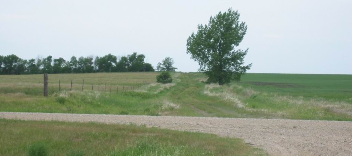
Looking West => What Original Roads Looked Like In Pioneer Days; Just Dirt Ruts In The Deep Grass.
."All right, tonight well camp out." We had talked about it before. .. So we move down the empty road. I dont want to own these prairies, or photograph them, or change them, or even stop or even keep going. We are just moving down the empty road. [End ZMM Chapter 4.]
12 Mi East of Hague, ND. The /\ Above /\ Photo shows what first original roads must have looked like in pioneer days. Click photo to get largest view and look closely to see the "dirt rut in the grass" leading to the horizon.
.On account of a fairly large Pothole Lake Rt-11 => Doesn't here as we might expect, continue straight (West ) ahead,,, AND (as shown /\ Above /\ Photo), go over the crest seen. In distance.
Rt-11 could here continue straight ahead,. West to Hague, ND, AND could simply enough, curve around the edge of the Pothole. This would give least distance to pave, and far easier, safer driving!
. .For some strange reason => Instead Rt-11 (as shown /\ Above /\ Photo), here curves 90 deg to the left, and goes an even mile to the next "Section Line", and then follows that Section Line, West for even full four miles, to the next "Section Line", only there to jog an even mile back to the North, and there-upon turn West, where the road should have already been.
. Crazy!
.These four 90 deg turns, add four dangerous sharp curves, and a lot more road to build and maintain! LOW Quality!
. If you don't believe me, look at your map just North of Zeeland, ND. Alternatively you could use the Satellite View, Blue Link given on 14th Photo Previous, back at Oakes, ND.
*************************
(Photo = 103-0360c ...... ZMM Page = 043 ...... WayPt = 046`|w|' 2132ft)