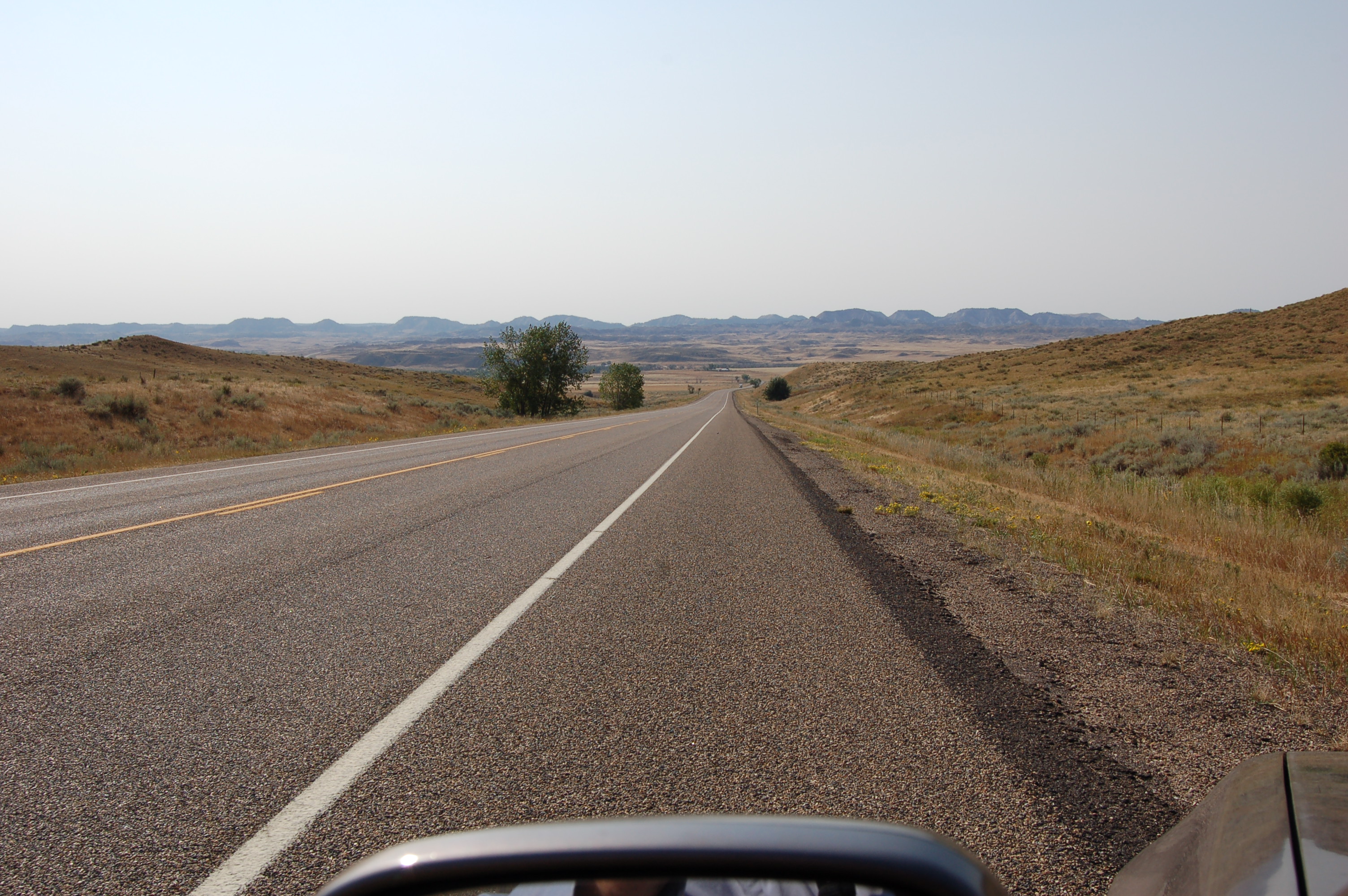
As Is Discerned By The Traveler, The Broad Valley Of Montanas Powder River => This Is The ZMM Narrators Low Rimed Canyon
..((Click Photo Several Times, To Get The Largest DRAMATIC View.)
.AND At The Horizon Beyond, Is The Crest of The Major Ridge, Where Chris, The Sutherlands, and The Narrator, Over-Look Miles City MT.
.Moreover => In Photo /\ Above /\, Looking Along the Pavement & Continue Straight, You See Some Light Brown Grass, Then at Lowest Level, A Horizontal Dark Line Of Trees=> These Trees Grow With Water From, & Thus Mark, The Powder River, Which Over Eons Of Time, Created This Low Rimed Canyon.
Along US-12 => 38.1 Miles W of Plevna, MT, and 0.6 Miles E of Powder River, MT.
Once-Upon-A-Time => And AT The River Ahead , Was, The Very Small Town of Locate, MT, Which Seems Now To Exist Only In Human Memories & Old Documents!
. DATE-LINE 16 JAN 2021 By Henry S Gurr.
Many of My Photos Of This Album (and Others), Mention The Town of Locate, MT. This is because back in 2002 when this album was originally created, this town was marked on my old 1978 Rand- McNally Road Atlas, as being close to East Side of The Powder River and close to US-12. And back in 2002 I seem to remember other references to it. However, on my ZMM Route Research Trips (2002, 2006, 2019), I did not notice any evidence of any town or buildings, as I continued through here traveling along on US-12.
Now-A-Days, Google Maps Does NOT Show Locate, MT, NOR Can Google Searches Find Where It Is.
A) When I Google Locate Montana (with quotes) Mostly all I can find with is => 1) Powder River Water Quality & Quantity of Flow Reports near Locate MT, and 2) 1940s Post Cards with Photos of Bills Powder River Standard Oil Gas Station. at Locate, MT, which is shown NEXT Photo 3) The mention of a Highway History Sign saying => Montana Highway 12 West side of Powder River Near what once was Locate, Montana, 4) A Persons Testimony => Turn off from Montana Highway 12 East side of Powder River Near what once was Locate, Montana. [Cluster County Road 403] Goes to Campbell Ranch, homesteaded by my great-grandfather Edward Campbell; operated today by my cousin and her husband, Cassie & Bill Erickson.
When I Google Locate MT (with quotes) Mostly all I can find with is => Weather & Maps, such as => 1) Hourly Weather-Locate, MT, 2) USGS US Topo 7.5-minute map for Locate, MT 2017, 3) Similar Map from FrugalNavagator.com.
. B) AND looking very close at Internet Google Satellite Map (Link Below), All Around Where US-12 Crosses The Powder River => There are shown several Ranch Operation Centers (House, Barns, Feed Lots). One of these, which is by US-12, ~500 feet NE of the current day Bridge over the Powder River, might have traces of an old town.
. FINAL CONCLUSION =>As Is Shown In This (Click Here) Satellite View => The Town of Locate, MT, VERY Likely Was, At The NW and SW Corners of US-12 and Mizpah Road, Click Here. (This road is also labeled Powder River Road and likely also is Cluster County Road 403), => After the above link comes up, you will see at the NW and SW Corners Respectively => 3) What looks like a rather modern home (with a rectangular outline of a small yard,) and 4) Just South of US-12, there are 3 trees and other faint traces of human activity. Trees here, had to have been planted by humans, AND compatible with where Cross-Road Businesses might have been (Such as the above-mentioned Bills Powder River Standard Oil Gas Station,) there are more faint traces of human activity!
C) AND just now (to complete the job), I looked at => My other collected old Rand- McNally Road Atlas (2002, 2005, 2006), AND AS WELL => Looked for Locate, MT in the most recent Montana Department of Transportations Highway Map, to find on all of these that => Locate is NOT shown. However (with the + magnified to max) the Montana Highway Map 1963. Click Here. , Does YES show Locate, MT as ~halfway between the Powder River, and the Next Major Crossroad East.
***********************************
(Photo = Summer 2006 0391 ...... ZMM Page = 077 ...... WayPt = A bit East of 2002 WayPt 93 )
