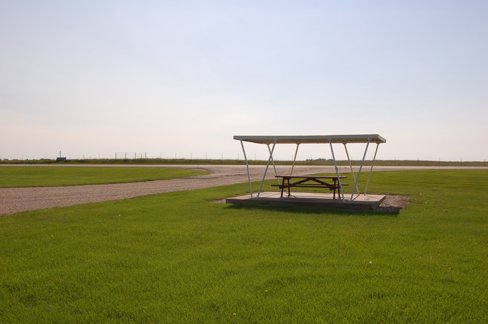
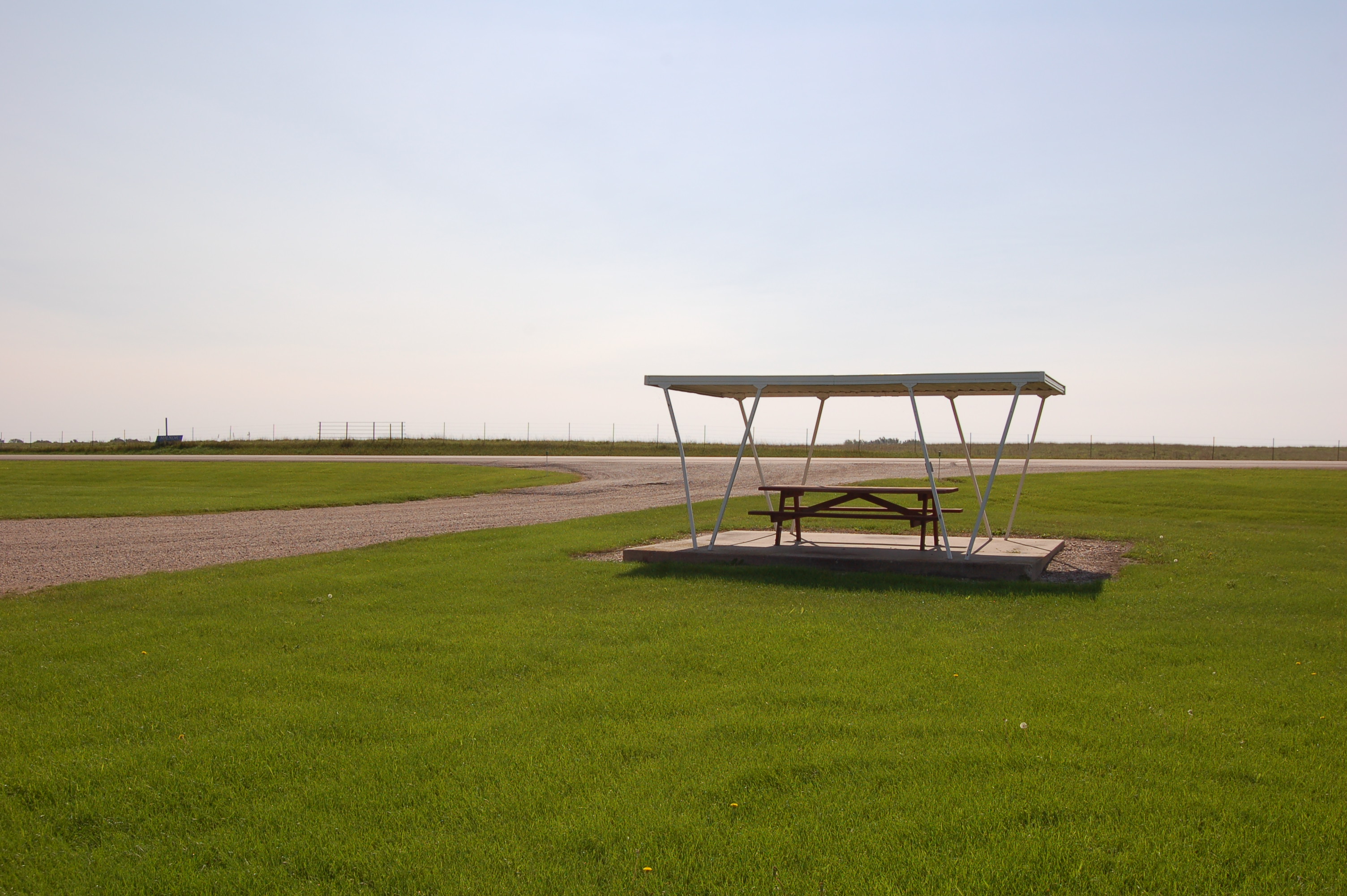
We Interrupt the ZMM Narrator's Storm Drama Narrative To Show You The Long Lost Site of Pirsig's Most Famous 1968 Photo!
"Up ahead the other riders, John Sutherland and his wife, Sylvia, have pulled into a roadside picnic area. Its time to stretch."
EXPLANATION:
.Ever since crossing the Border into ND, Rt 13 has been to the West
Arrow Straight
for 40 miles. But slightly South of Wyndmere, ND , Rt 13 suddenly, turns to go the SW SW, only to straighten out to go
Again Go West.
Arrow Straight
For another 26 miles, and suddenly Rt 13, AGAIN turns to go the SW.
HERE the ZMM Route Traveler
should SLOW-DOWN => This is where upon the /\ Above /\ Photo scene appears! This offers proof that HERE, South of Milnor ND. , is the physical site of Robert Pirsig's First Three Of Twelve Color Photos. Click Here, and THEN AFTER Albums Page Comes Up => Click on TOP Album, Alternatively these photos are shown in the First Photo Album In Main Menu At Left.
MORE EXPLANATION =>
.Folks at the Dakota Valley Electric Cooperative, told us that their REA Co-op built this picnic area right beside their own Coop Buildings in ~1966, not long prior to the ZMM Narrator's 1968 trip. Since the Historical Marker Park for Camp Buell , happens to be adjacent, they also take care of the mowing and maintenance of the Park as well as this Photo /\ Above /\ Picnic Canopy Area. RIGHT CLICK AND SELECT NEW TAB => After Satellite Map View Comes Up, You will See ~ ZMM Route 13 going by The Dakota Valley Electric Cooperative, AND straight down from the White Roofed Building, you see a Small Whitish Square, by the Driveway. THIS is the => The Picnic Canopy of => The Long Lost Site of Pirsig's Most Famous 1968 Photo!
. After Satellite Map View Comes Up, you may ClickOn The Plus&Minus To Zoom. You can Click&Drag Map In Any Direction, to See More Off Your Screen Edges.
Why Is THIS Rest Stop Not Mentioned In ZMM?
.
.As the above ZMM passage indicates, Our ZMM Riders needed to stop regularly to rest and stretch. We note that earlier rest stops in Minnesota on Rt 55, were mentioned, so, why THIS rest stop not mentioned? The answer is immediately apparent:
.This stretch of road from Breckenridge to Oakes is fully occupied with the drama of the lightning storm, the high-speed chase to avoid heavy rain, & the brilliant flash of lightning, whereupon Phaedrus see the Ghost!
.Having a "rest break" here would break all the carefully built drama!! This would not do!!! End Of This Story.
NEW TOPIC: How did Gary Wegner Find the Robert Pirsig Picnic Canopy Shown /\ Above /\ ?. For a long time the geographical location of Pirsig's picnic area has been unknown, despite widespread efforts to the contrary. Finally, Pirsig Pilgrim Gary Wegner, taking leadership, wrote to the County Engineers in the North Dakota Counties of Richland and Sargent. Tim Schulte, Richland County Engineer, replied: I did some checking with various folks in Richland County and nobody could remember a rest area along State Highway 13 in Richland County. (Continued next photo.)
************************************
(Photo = Summer2006-0217 ...... ZMM Page = 025 ...... WayPt = -017i)